
Magnitude |
:3.4 |
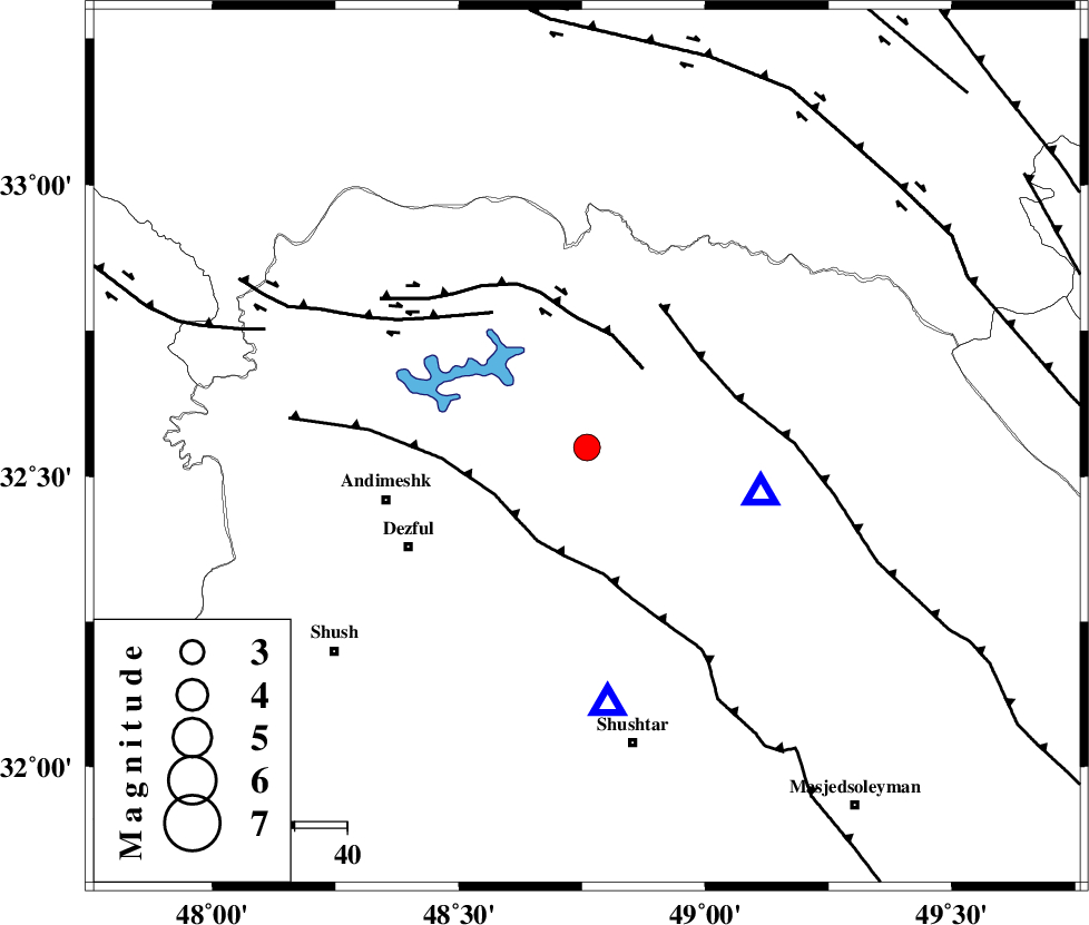
| Date & Time (UTC) | 2012-04-27 13:27:47.4 |
| Date & Time (Local) | 1391/2/8 17:57:47.4 |
| Location | Lat:32.55 Lon: 48.76 |
| Region | Khoozestan Province, 40 km East of Andimeshk |
Nearest Cities |
|
| 9 km North of Sardasht, Khoozestan Province | |
| 20 km North of Mahur berenji, Khoozestan Province | |
| 28 km South of Shuy, Khoozestan Province | |
| 34 km North of Gatvand, Khoozestan Province | |
| 37 km North West of Lali, Khoozestan Province | |
| Depth | 16 km |
| Agency | |
Faults within 150 km: |
|
| BALARUD_F_Z2 (Length: 58 km) , Distance to epicenter: 18 km | |
| DEZFUL_EMBAYMENT (Length: 228 km) , Distance to epicenter: 20 km | |
| MFF2 (Length: 205 km) , Distance to epicenter: 28 km | |
| Number of Phases | 5 |
| RMS | 0 |
| Number of Stations | 5 |
| Error in Latitude | >1.9 km |
| Error in Longitude | 3.5 km |
| Error in Depth | 3.8 km |
Download waveform in seisan format
to download seisan software Click here
to access information about IIEES stations Click here
Amplitude | ||||||||
| UID | Agency | Station | Component | Amplitude | Period | Arrival Time | Proccessing Time | Signal Clip |
| 83129 | IIEES | SHGR | E | 2514.1 | 0.72 | 2012-04-27 13:28:11 | 2012-04-27 01:49:00 | n |
| 83130 | IIEES | SHGR | N | 2713.2 | 0.48 | 2012-04-27 13:28:15 | 2012-04-27 01:49:00 | n |
| 83131 | IIEES | KHMZ | E | 551 | 0.48 | 2012-04-27 13:28:43 | 2012-04-27 01:49:00 | n |
| 83132 | IIEES | GHVR | N | 105.4 | 0.48 | 2012-04-27 13:29:22 | 2012-04-27 01:49:00 | n |
Phase | ||||||||||||
| Agency | Station | Component | Phase Type | Phase Quality | First Motion | Observed Arrival Time | Time Residual | Loc. Flag | Input Weight | Distance | Azimuth | |
| IIEES | SHGR | Z | Pg | E | 2012-04-27 13:27:56 | 0 | y | 49.4 | 176 | |||
| IIEES | KHMZ | Z | Pg | E | 2012-04-27 13:28:16 | 0 | y | 173 | 40 | |||
| IIEES | ASAO | Z | Pn | E | 2012-04-27 13:28:26 | 0.02 | y | 250 | 28 | |||
| IIEES | SNGE | Z | Pn | E | 2012-04-27 13:28:33 | -0.01 | y | 311 | 335 | |||
| IIEES | GHVR | Z | Pn | E | 2012-04-27 13:28:33 | -0.02 | y | 314 | 46 | |||