
Magnitude |
:3 |
| Date & Time (UTC) | 2012-04-25 23:47:56.9 |
| Date & Time (Local) | 1391/2/7 04:17:56.9 |
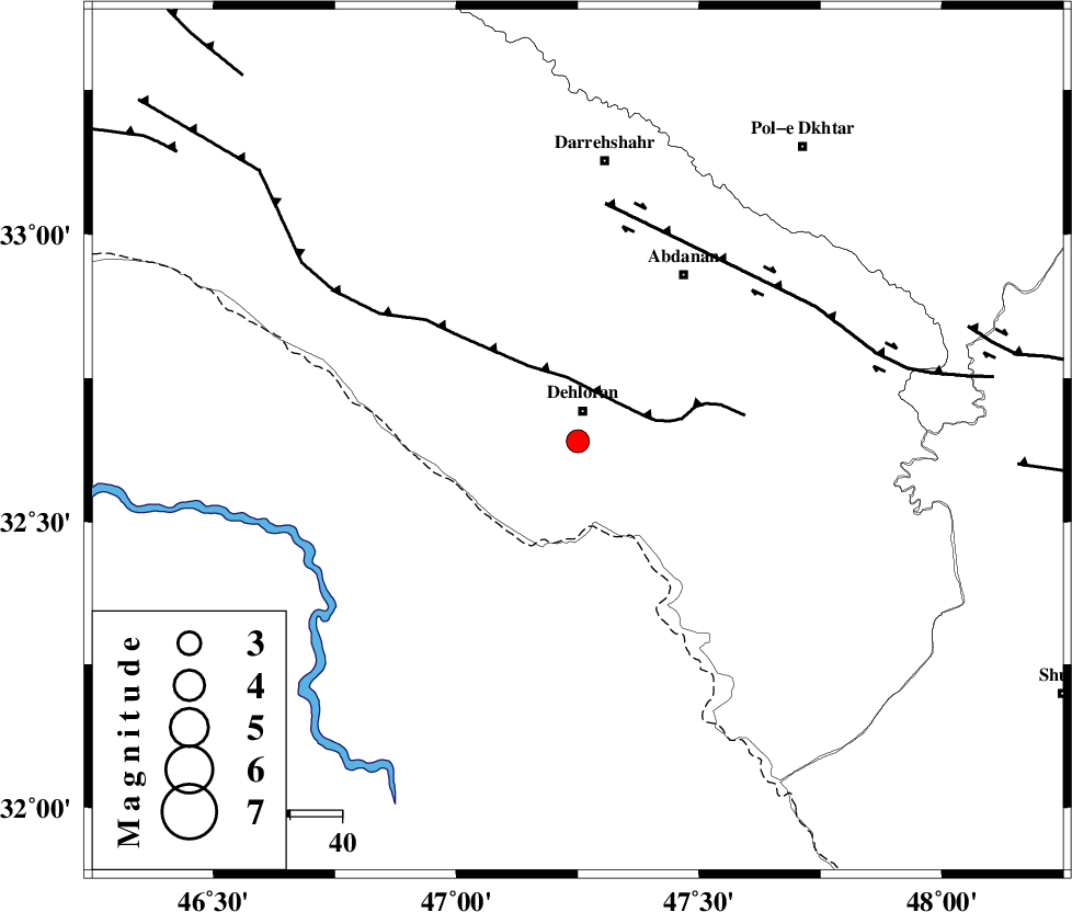
| Location | Lat:32.64 Lon: 47.25 |
| Region | Ilam Province, 6 km Dehloran |
Nearest Cities |
|
| 6 km of Dehloran, Ilam Province | |
| 15 km North West of Musian, Ilam Province | |
| 33 km South East of Bishehzar, Ilam Province | |
| 38 km South West of Abdanan, Ilam Province | |
| 41 km South West of Sarabbagh, Ilam Province | |
| Depth | 14 km |
| Agency | |
Faults within 150 km: |
|
| MFF6 (Length: 144 km) , Distance to epicenter: 11 km | |
| BALARUD_F_Z1 (Length: 87 km) , Distance to epicenter: 46 km | |
| BALARUD_F_Z3 (Length: 53 km) , Distance to epicenter: 78 km | |
| Number of Phases | 7 |
| RMS | 0.1 |
| Number of Stations | 5 |
| Error in Latitude | >4.6 km |
| Error in Longitude | 8.1 km |
| Error in Depth | 6.1 km |
Download waveform in seisan format
to download seisan software Click here
to access information about IIEES stations Click here
Amplitude | ||||||||
| UID | Agency | Station | Component | Amplitude | Period | Arrival Time | Proccessing Time | Signal Clip |
| 83090 | IIEES | SHGR | E | 432.9 | 0.4 | 2012-04-25 23:48:47 | 2012-04-26 12:37:00 | n |
| 83091 | IIEES | SHGR | N | 289.5 | 0.48 | 2012-04-25 23:48:48 | 2012-04-26 12:37:00 | n |
| 83092 | IIEES | SNGE | N | 33.5 | 0.56 | 2012-04-25 23:49:25 | 2012-04-26 12:37:00 | n |
| 83093 | IIEES | SNGE | E | 42.6 | 0.6 | 2012-04-25 23:49:30 | 2012-04-26 12:37:00 | n |
Phase | ||||||||||||
| Agency | Station | Component | Phase Type | Phase Quality | First Motion | Observed Arrival Time | Time Residual | Loc. Flag | Input Weight | Distance | Azimuth | |
| IIEES | SHGR | Z | Pn | E | 2012-04-25 23:48:23 | -0.23 | y | 158 | 112 | |||
| IIEES | SHGR | E | Sg | E | 2012-04-25 23:48:42 | 0.09 | y | 158 | 112 | |||
| IIEES | SNGE | Z | Pn | E | 2012-04-25 23:48:38 | 0.17 | y | 272 | 2 | |||
| IIEES | SNGE | E | Sg | E | 2012-04-25 23:49:13 | -0.1 | y | 272 | 2 | |||
| IIEES | KHMZ | Z | Pn | E | 2012-04-25 23:48:39 | -0.09 | y | 281 | 64 | |||
| IIEES | ASAO | Z | Pn | E | 2012-04-25 23:48:46 | 0.18 | y | 334 | 50 | |||
| IIEES | GHVR | Z | Pn | E | 2012-04-25 23:48:57 | 0 | y | 424 | 60 | |||