
Magnitude |
:4.1 |
| Date & Time (UTC) | 2012-04-22 08:13:54.8 |
| Date & Time (Local) | 1391/2/3 12:43:54.8 |
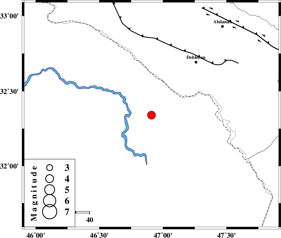
| Location | Lat:32.34 Lon: 46.91 |
| Region | Iraq, 51 km South-West of Dehloran |
Nearest Cities |
|
| 48 km South West of Musian, Ilam Province | |
| 51 km South West of Dehloran, Ilam Province | |
| 54 km South of Bishehzar, Ilam Province | |
| 84 km South West of Abdanan, Ilam Province | |
| 87 km South West of Sarabbagh, Ilam Province | |
| Depth | 37 km |
| Agency | |
Faults within 150 km: |
|
| MFF6 (Length: 144 km) , Distance to epicenter: 53 km | |
| BALARUD_F_Z1 (Length: 87 km) , Distance to epicenter: 88 km | |
| ZFF4 (Length: 128 km) , Distance to epicenter: 100 km | |
| Number of Phases | 8 |
| RMS | 0.1 |
| Number of Stations | 8 |
| Error in Latitude | >3.2 km |
| Error in Longitude | 5.5 km |
| Error in Depth | 3.7 km |
Download waveform in seisan format
to download seisan software Click here
to access information about IIEES stations Click here
Amplitude | ||||||||
| UID | Agency | Station | Component | Amplitude | Period | Arrival Time | Proccessing Time | Signal Clip |
| 83007 | IIEES | SHGR | E | 1809.7 | 0.42 | 2012-04-22 08:14:48 | 2012-04-22 08:28:00 | n |
| 83008 | IIEES | SHGR | N | 1872.3 | 0.5 | 2012-04-22 08:14:53 | 2012-04-22 08:28:00 | n |
| 83009 | IIEES | SNGE | N | 1248.2 | 0.65 | 2012-04-22 08:15:28 | 2012-04-22 08:28:00 | n |
| 83010 | IIEES | SNGE | E | 737 | 0.7 | 2012-04-22 08:15:30 | 2012-04-22 08:28:00 | n |
| 83011 | IIEES | KHMZ | N | 289.8 | 0.46 | 2012-04-22 08:15:31 | 2012-04-22 08:28:00 | n |
Phase | ||||||||||||
| Agency | Station | Component | Phase Type | Phase Quality | First Motion | Observed Arrival Time | Time Residual | Loc. Flag | Input Weight | Distance | Azimuth | |
| IIEES | SHGR | Z | Pg | E | 2012-04-22 08:14:24 | 0 | y | 180 | 98 | |||
| IIEES | SNGE | Z | Pn | E | 2012-04-22 08:14:38 | 0.02 | y | 308 | 7 | |||
| IIEES | KHMZ | Z | Pn | E | 2012-04-22 08:14:40 | 0.01 | y | 325 | 61 | |||
| IIEES | ASAO | Z | Pn | E | 2012-04-22 08:14:47 | -0.02 | y | 379 | 49 | |||
| IIEES | GHVR | Z | Pn | E | 2012-04-22 08:14:58 | 0.09 | y | 468 | 58 | |||
| IIEES | CHTH | Z | Pn | E | 2012-04-22 08:15:09 | -0.11 | y | 555 | 43 | |||
| IIEES | GHIR | Z | Pn | E | 2012-04-22 08:15:31 | -0.02 | y | 737 | 126 | |||
| IIEES | TABS | Z | Pn | E | 2012-04-22 08:16:00 | 0.04 | y | 965 | 79 | |||