
Magnitude |
:3 |
| Date & Time (UTC) | 2012-04-21 20:00:57.5 |
| Date & Time (Local) | 1391/2/3 00:30:57.5 |
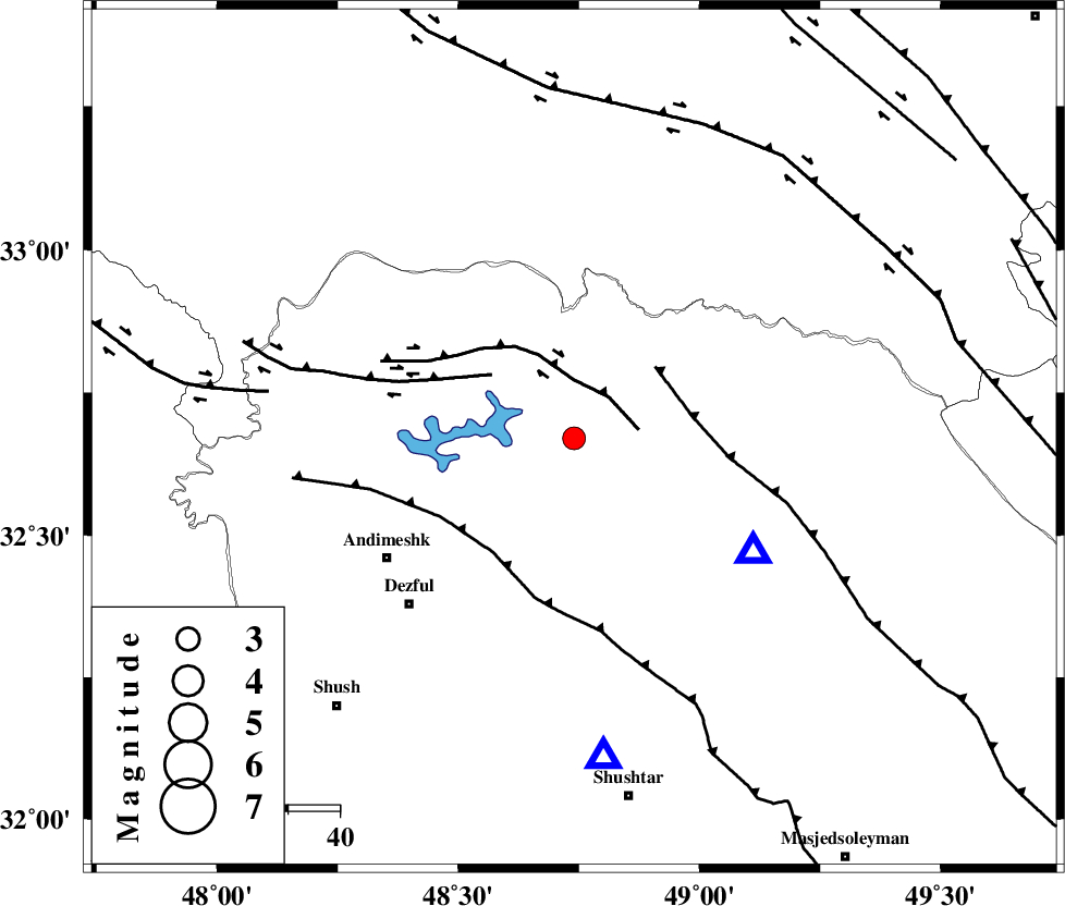
| Location | Lat:32.67 Lon: 48.74 |
| Region | Khoozestan Province, 44 km North-East of Andimeshk |
Nearest Cities |
|
| 16 km South of Shuy, Khoozestan Province | |
| 21 km North of Sardasht, Khoozestan Province | |
| 32 km North of Mahur berenji, Khoozestan Province | |
| 40 km South East of Sorkhakan, Khoozestan Province | |
| 43 km North East of Andimeshk, Khoozestan Province | |
| Depth | 14 km |
| Agency | |
Faults within 150 km: |
|
| BALARUD_F_Z2 (Length: 58 km) , Distance to epicenter: 11 km | |
| BALARUD_F_Z3 (Length: 53 km) , Distance to epicenter: 20 km | |
| MFF2 (Length: 205 km) , Distance to epicenter: 21 km | |
| Number of Phases | 5 |
| RMS | 0.1 |
| Number of Stations | 5 |
| Error in Latitude | >2.5 km |
| Error in Longitude | 4.6 km |
| Error in Depth | 5.5 km |
Download waveform in seisan format
to download seisan software Click here
to access information about IIEES stations Click here
Amplitude | ||||||||
| UID | Agency | Station | Component | Amplitude | Period | Arrival Time | Proccessing Time | Signal Clip |
| 82980 | IIEES | SHGR | N | 1372.7 | 0.68 | 2012-04-21 20:01:27 | 2012-04-21 08:24:00 | n |
| 82981 | IIEES | SHGR | E | 956.1 | 0.64 | 2012-04-21 20:01:31 | 2012-04-21 08:24:00 | n |
| 82982 | IIEES | SNGE | E | 36.1 | 0.64 | 2012-04-21 20:02:29 | 2012-04-21 08:24:00 | n |
| 82983 | IIEES | GHVR | N | 39.9 | 0.72 | 2012-04-21 20:02:34 | 2012-04-21 08:24:00 | n |
Phase | ||||||||||||
| Agency | Station | Component | Phase Type | Phase Quality | First Motion | Observed Arrival Time | Time Residual | Loc. Flag | Input Weight | Distance | Azimuth | |
| IIEES | SHGR | Z | Pg | E | 2012-04-21 20:01:08 | 0.02 | y | 63 | 175 | |||
| IIEES | KHMZ | Z | Pg | E | 2012-04-21 20:01:24 | -0.18 | y | 164 | 44 | |||
| IIEES | ASAO | Z | Pn | E | 2012-04-21 20:01:35 | 0.16 | y | 240 | 29 | |||
| IIEES | SNGE | Z | Pn | E | 2012-04-21 20:01:42 | -0.09 | y | 298 | 335 | |||
| IIEES | GHVR | Z | Pn | E | 2012-04-21 20:01:43 | 0.09 | y | 307 | 49 | |||