
Magnitude |
:3 |
| Date & Time (UTC) | 2012-04-20 15:57:58.5 |
| Date & Time (Local) | 1391/2/1 20:27:58.5 |
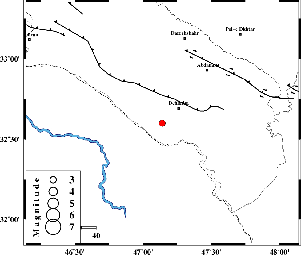
| Location | Lat:32.6 Lon: 47.14 |
| Region | Ilam Province, 15 km West of Dehloran |
Nearest Cities |
|
| 15 km West of Dehloran, Ilam Province | |
| 21 km North West of Musian, Ilam Province | |
| 29 km South East of Bishehzar, Ilam Province | |
| 48 km South West of Abdanan, Ilam Province | |
| 52 km South West of Sarabbagh, Ilam Province | |
| Depth | 14 km |
| Agency | |
Faults within 150 km: |
|
| MFF6 (Length: 144 km) , Distance to epicenter: 19 km | |
| BALARUD_F_Z1 (Length: 87 km) , Distance to epicenter: 53 km | |
| BALARUD_F_Z3 (Length: 53 km) , Distance to epicenter: 90 km | |
| Number of Phases | 5 |
| RMS | 0.2 |
| Number of Stations | 4 |
| Error in Latitude | >4.7 km |
| Error in Longitude | 11 km |
| Error in Depth | 5.5 km |
Download waveform in seisan format
to download seisan software Click here
to access information about IIEES stations Click here
Amplitude | ||||||||
| UID | Agency | Station | Component | Amplitude | Period | Arrival Time | Proccessing Time | Signal Clip |
| 82919 | IIEES | SHGR | E | 238 | 0.68 | 2012-04-20 15:58:50 | 2012-04-20 04:25:00 | n |
| 82920 | IIEES | SHGR | N | 257.7 | 0.4 | 2012-04-20 15:58:52 | 2012-04-20 04:25:00 | n |
| 82921 | IIEES | SNGE | E | 61.8 | 0.44 | 2012-04-20 15:59:23 | 2012-04-20 04:25:00 | n |
Phase | ||||||||||||
| Agency | Station | Component | Phase Type | Phase Quality | First Motion | Observed Arrival Time | Time Residual | Loc. Flag | Input Weight | Distance | Azimuth | |
| IIEES | SHGR | Z | Pg | E | 2012-04-20 15:58:25 | -0.09 | y | 166 | 109 | |||
| IIEES | SNGE | Z | Pn | E | 2012-04-20 15:58:40 | -0.02 | y | 277 | 4 | |||
| IIEES | SNGE | N | Sg | E | 2012-04-20 15:59:16 | -0.07 | y | 277 | 4 | |||
| IIEES | KHMZ | Z | Pn | E | 2012-04-20 15:58:42 | -0.15 | y | 292 | 64 | |||
| IIEES | ASAO | Z | Pn | E | 2012-04-20 15:58:49 | 0.36 | y | 344 | 50 | |||