
Magnitude |
:4.4 |
| Date & Time (UTC) | 2012-04-20 03:56:25.6 |
| Date & Time (Local) | 1391/2/1 08:26:25.6 |
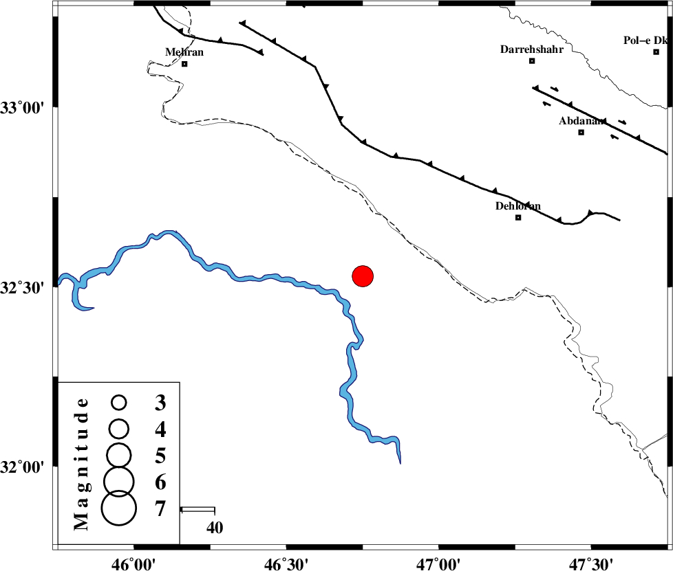
| Location | Lat:32.53 Lon: 46.75 |
| Region | Iraq, 51 km South-West of Dehloran |
Nearest Cities |
|
| 39 km South West of Bishehzar, Ilam Province | |
| 51 km South West of Dehloran, Ilam Province | |
| 57 km West of Musian, Ilam Province | |
| 80 km South West of Meymeh, Ilam Province | |
| 81 km South West of Abdanan, Ilam Province | |
| Depth | 14 km |
| Agency | |
Faults within 150 km: |
|
| MFF6 (Length: 144 km) , Distance to epicenter: 38 km | |
| ZFF4 (Length: 128 km) , Distance to epicenter: 75 km | |
| BALARUD_F_Z1 (Length: 87 km) , Distance to epicenter: 78 km | |
| Number of Phases | 6 |
| RMS | 0.1 |
| Number of Stations | 5 |
| Error in Latitude | >4.1 km |
| Error in Longitude | 10.6 km |
| Error in Depth | 5.2 km |
Download waveform in seisan format
to download seisan software Click here
to access information about IIEES stations Click here
Amplitude | ||||||||
| UID | Agency | Station | Component | Amplitude | Period | Arrival Time | Proccessing Time | Signal Clip |
| 82896 | IIEES | SHGR | N | 4257.6 | 0.52 | 2012-04-20 03:57:30 | 2012-04-20 04:51:00 | n |
| 82897 | IIEES | SHGR | E | 3694.3 | 0.4 | 2012-04-20 03:57:30 | 2012-04-20 04:51:00 | n |
| 82898 | IIEES | SNGE | E | 1097.3 | 0.68 | 2012-04-20 03:57:52 | 2012-04-20 04:51:00 | n |
Phase | ||||||||||||
| Agency | Station | Component | Phase Type | Phase Quality | First Motion | Observed Arrival Time | Time Residual | Loc. Flag | Input Weight | Distance | Azimuth | |
| IIEES | SHGR | Z | Pg | E | 2012-04-20 03:56:58 | -0.17 | y | 199 | 103 | |||
| IIEES | SNGE | Z | Pn | E | 2012-04-20 03:57:09 | -0.1 | y | 290 | 11 | |||
| IIEES | SNGE | E | Sg | E | 2012-04-20 03:57:47 | -0.03 | y | 290 | 11 | |||
| IIEES | KHMZ | Z | Pn | E | 2012-04-20 03:57:14 | 0.29 | y | 329 | 65 | |||
| IIEES | ASAO | Z | Pn | E | 2012-04-20 03:57:20 | 0.08 | y | 378 | 53 | |||
| IIEES | GHVR | Z | Pn | E | 2012-04-20 03:57:31 | -0.05 | y | 471 | 61 | |||