
Magnitude |
:4.2 |
| Date & Time (UTC) | 2012-04-20 03:31:41.1 |
| Date & Time (Local) | 1391/2/1 08:01:41.1 |
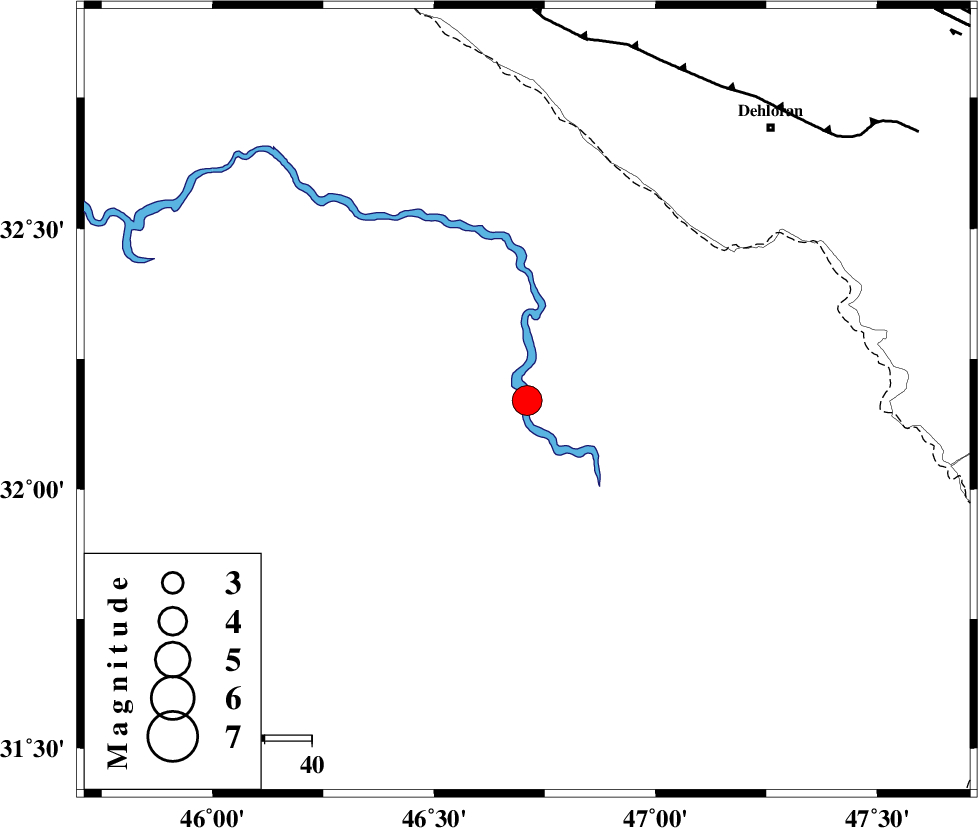
| Location | Lat:32.17 Lon: 46.71 |
| Region | Iraq, 78 km South-West of Dehloran |
Nearest Cities |
|
| 74 km South West of Musian, Ilam Province | |
| 77 km South West of Bishehzar, Ilam Province | |
| 78 km South West of Dehloran, Ilam Province | |
| 110 km South West of Abdanan, Ilam Province | |
| 114 km South West of Sarabbagh, Ilam Province | |
| Depth | 37 km |
| Agency | |
Faults within 150 km: |
|
| MFF6 (Length: 144 km) , Distance to epicenter: 78 km | |
| ZFF4 (Length: 128 km) , Distance to epicenter: 112 km | |
| BALARUD_F_Z1 (Length: 87 km) , Distance to epicenter: 113 km | |
| Number of Phases | 6 |
| RMS | 0.1 |
| Number of Stations | 5 |
| Error in Latitude | >9.3 km |
| Error in Longitude | 5.1 km |
| Error in Depth | 6.4 km |
Download waveform in seisan format
to download seisan software Click here
to access information about IIEES stations Click here
Amplitude | ||||||||
| UID | Agency | Station | Component | Amplitude | Period | Arrival Time | Proccessing Time | Signal Clip |
| 82886 | IIEES | SHGR | N | 8755.9 | 0.56 | 2012-04-20 03:32:45 | 2012-04-20 04:03:00 | n |
| 82887 | IIEES | SHGR | E | 7222 | 0.72 | 2012-04-20 03:32:46 | 2012-04-20 04:03:00 | n |
| 82888 | IIEES | SNGE | N | 241.5 | 0.52 | 2012-04-20 03:33:15 | 2012-04-20 04:03:00 | n |
| 82889 | IIEES | SNGE | E | 257.7 | 0.56 | 2012-04-20 03:33:18 | 2012-04-20 04:03:00 | n |
Phase | ||||||||||||
| Agency | Station | Component | Phase Type | Phase Quality | First Motion | Observed Arrival Time | Time Residual | Loc. Flag | Input Weight | Distance | Azimuth | |
| IIEES | SHGR | Z | Pg | E | 2012-04-20 03:32:13 | -0.01 | y | 198 | 91 | |||
| IIEES | SHGR | N | Sg | E | 2012-04-20 03:32:36 | 0.01 | y | 198 | 91 | |||
| IIEES | SNGE | Z | Pn | E | 2012-04-20 03:32:27 | 0.02 | y | 329 | 10 | |||
| IIEES | KHMZ | Z | Pn | E | 2012-04-20 03:32:30 | 0.12 | y | 351 | 59 | |||
| IIEES | ASAO | Z | Pn | E | 2012-04-20 03:32:37 | -0.08 | y | 406 | 49 | |||
| IIEES | GHVR | Z | Pn | E | 2012-04-20 03:32:48 | -0.09 | y | 494 | 58 | |||