
Magnitude |
:5 |
| Date & Time (UTC) | 2012-04-20 01:21:10.9 |
| Date & Time (Local) | 1391/2/1 05:51:10.9 |
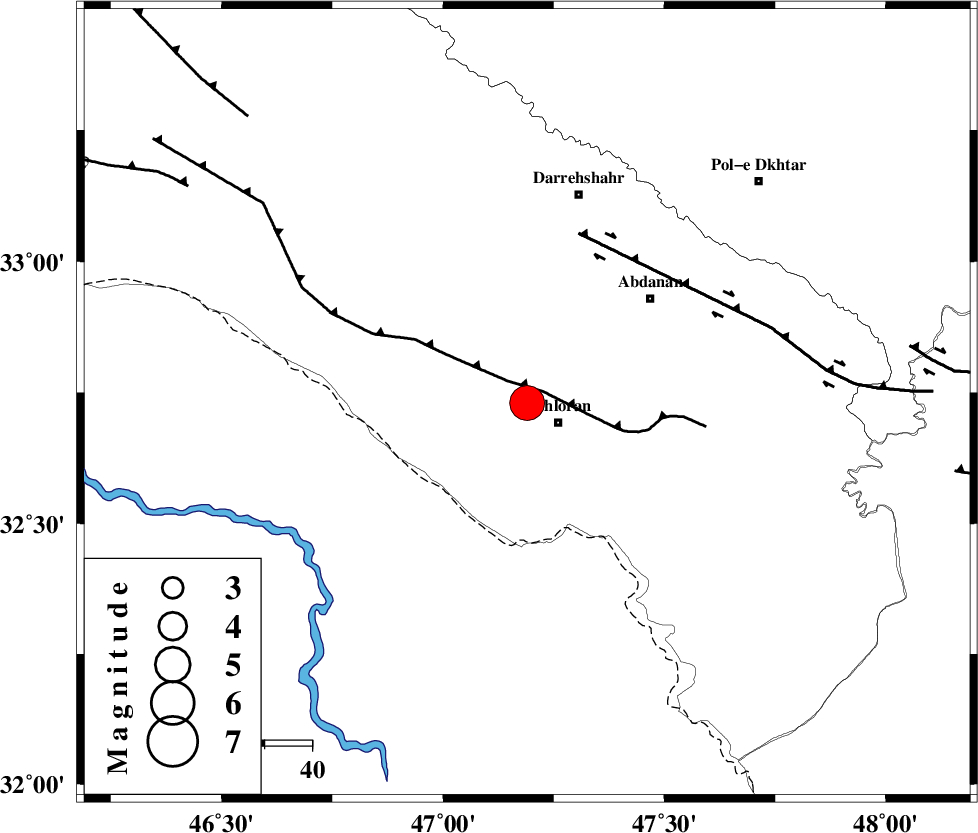
| Location | Lat:32.73 Lon: 47.19 |
| Region | Ilam Province, 8 km Dehloran |
Nearest Cities |
|
| 8 km North of Dehloran, Ilam Province | |
| 23 km East of Bishehzar, Ilam Province | |
| 26 km North West of Musian, Ilam Province | |
| 34 km South West of Abdanan, Ilam Province | |
| 40 km South West of Sarabbagh, Ilam Province | |
| Depth | 14 km |
| Agency | |
Faults within 150 km: |
|
| MFF6 (Length: 144 km) , Distance to epicenter: 4 km | |
| BALARUD_F_Z1 (Length: 87 km) , Distance to epicenter: 38 km | |
| BALARUD_F_Z3 (Length: 53 km) , Distance to epicenter: 82 km | |
| Number of Phases | 6 |
| RMS | 0.2 |
| Number of Stations | 5 |
| Error in Latitude | >4 km |
| Error in Longitude | 7.7 km |
| Error in Depth | 5.3 km |
Download waveform in seisan format
to download seisan software Click here
to access information about IIEES stations Click here
Amplitude | ||||||||
| UID | Agency | Station | Component | Amplitude | Period | Arrival Time | Proccessing Time | Signal Clip |
| 82868 | IIEES | SHGR | N | 21458 | 0.56 | 2012-04-20 01:22:04 | 2012-04-20 01:49:00 | n |
| 82869 | IIEES | SHGR | E | 24281.4 | 0.52 | 2012-04-20 01:22:04 | 2012-04-20 01:49:00 | n |
| 82870 | IIEES | SNGE | E | 4908.9 | 0.52 | 2012-04-20 01:22:37 | 2012-04-20 01:49:00 | n |
| 82871 | IIEES | SNGE | N | 4113.2 | 0.56 | 2012-04-20 01:22:40 | 2012-04-20 01:49:00 | n |
| 82872 | IIEES | GHIR | N | 441.9 | 0.6 | 2012-04-20 01:24:14 | 2012-04-20 01:49:00 | n |
| 82873 | IIEES | GHIR | E | 402.2 | 0.48 | 2012-04-20 01:24:21 | 2012-04-20 01:49:00 | n |
Phase | ||||||||||||
| Agency | Station | Component | Phase Type | Phase Quality | First Motion | Observed Arrival Time | Time Residual | Loc. Flag | Input Weight | Distance | Azimuth | |
| IIEES | SHGR | Z | Pg | E | 2012-04-20 01:21:38 | -0.27 | y | 166 | 114 | |||
| IIEES | SHGR | N | Sg | E | 2012-04-20 01:21:58 | 0.14 | y | 166 | 114 | |||
| IIEES | SNGE | Z | Pn | E | 2012-04-20 01:21:51 | 0.1 | y | 262 | 3 | |||
| IIEES | SNGE | E | Sg | E | 2012-04-20 01:22:24 | -0.12 | y | 262 | 3 | |||
| IIEES | KHMZ | Z | Pn | E | 2012-04-20 01:21:53 | 0.01 | y | 281 | 66 | |||
| IIEES | ZNJK | Z | Pn | E | 2012-04-20 01:22:15 | 0.2 | y | 458 | 17 | |||