
Magnitude |
:4.3 |
| Date & Time (UTC) | 2012-04-17 02:37:41.7 |
| Date & Time (Local) | 1391/1/29 07:07:41.7 |
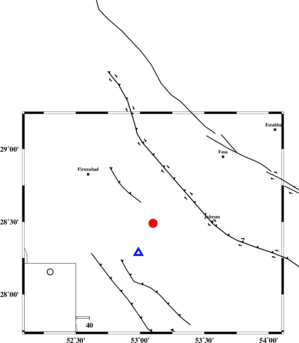
| Location | Lat:28.49 Lon: 53.1 |
| Region | Fars Province, 7 km Qir va Karzin |
Nearest Cities |
|
| 3 km North of Fathabad, Fars Province | |
| 7 km North of Qir va Karzin, Fars Province | |
| 9 km North of Shahrak-e jonubi, Fars Province | |
| 18 km South of Shaghun, Fars Province | |
| 26 km North West of Mobarakabad, Fars Province | |
| Depth | 15 km |
| Agency | |
Faults within 150 km: |
|
| QIR_F (Length: 130 km) , Distance to epicenter: 14 km | |
| SABZ_PUSHAN_F_Z2 (Length: 24 km) , Distance to epicenter: 36 km | |
| SABZ_PUSHAN_F_Z1 (Length: 69 km) , Distance to epicenter: 43 km | |
| Number of Phases | 7 |
| RMS | 0.3 |
| Number of Stations | 6 |
| Error in Latitude | >5.6 km |
| Error in Longitude | 3.3 km |
| Error in Depth | 5.9 km |
Download waveform in seisan format
to download seisan software Click here
to access information about IIEES stations Click here
Amplitude | ||||||||
| UID | Agency | Station | Component | Amplitude | Period | Arrival Time | Proccessing Time | Signal Clip |
| 82769 | IIEES | GHIR | N | 60966.5 | 0.4 | 2012-04-17 02:37:53 | 2012-04-17 02:58:00 | n |
| 82770 | IIEES | GHIR | E | 54439.1 | 0.52 | 2012-04-17 02:37:57 | 2012-04-17 02:58:00 | n |
| 82771 | IIEES | AHRM | N | 2696.1 | 0.48 | 2012-04-17 02:38:41 | 2012-04-17 02:58:00 | n |
Phase | ||||||||||||
| Agency | Station | Component | Phase Type | Phase Quality | First Motion | Observed Arrival Time | Time Residual | Loc. Flag | Input Weight | Distance | Azimuth | |
| IIEES | GHIR | Z | Pg | E | 2012-04-17 02:37:47 | 0.13 | y | 25.2 | 205 | |||
| IIEES | AHRM | Z | Pn | E | 2012-04-17 02:38:11 | -0.11 | y | 181 | 284 | |||
| IIEES | AHRM | E | Sg | E | 2012-04-17 02:38:33 | 0.04 | y | 181 | 284 | |||
| IIEES | KHMZ | Z | Pn | E | 2012-04-17 02:39:10 | -0.3 | y | 654 | 334 | |||
| IIEES | GHVR | Z | Pn | E | 2012-04-17 02:39:14 | 0.06 | y | 687 | 346 | |||
| IIEES | TABS | Z | Pn | E | 2012-04-17 02:39:15 | 0.49 | y | 689 | 33 | |||
| IIEES | CHBR | N | Pn | E | 2012-04-17 02:39:28 | -0.44 | y | 800 | 112 | |||