
Magnitude |
:2.7 |
| Date & Time (UTC) | 2012-04-13 20:42:36.8 |
| Date & Time (Local) | 1391/1/26 01:12:36.8 |
| Location | Lat:30.63 Lon: 51.15 |
| Region | Kohkiluieh va boyerahmad Province, 41 km West of Yasuj |
Nearest Cities |
|
| 21 km North West of Sepidar, Kohkiluieh va boyerahmad Province | |
| 22 km North East of Abdehgah, Kohkiluieh va boyerahmad Province | |
| 23 km South West of Chitab, Kohkiluieh va boyerahmad Province | |
| 30 km North of Basht, Kohkiluieh va boyerahmad Province | |
| 33 km South West of Kerik, Kohkiluieh va boyerahmad Province | |
| Depth | 18 km |
| Agency | |
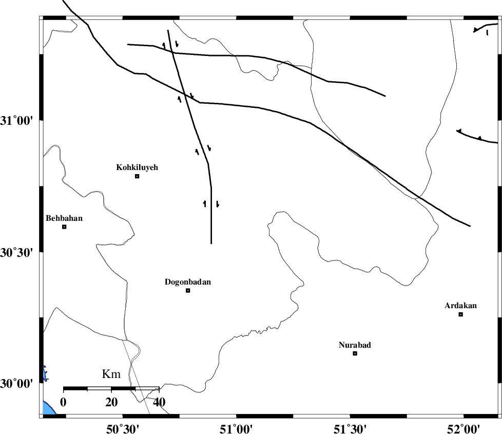
Faults within 150 km: |
|
| MISHAN_F (Length: 76 km) , Distance to epicenter: 38 km | |
| KAZERUN_F (Length: 96 km) , Distance to epicenter: 41 km | |
| DENA_F (Length: 137 km) , Distance to epicenter: 44 km | |
| Number of Phases | 5 |
| RMS | 0.1 |
| Number of Stations | 4 |
| Error in Latitude | >2.6 km |
| Error in Longitude | 8.3 km |
| Error in Depth | 6.9 km |
Download waveform in seisan format
to download seisan software Click here
to access information about IIEES stations Click here
Amplitude | ||||||||
| UID | Agency | Station | Component | Amplitude | Period | Arrival Time | Proccessing Time | Signal Clip |
| 82750 | IIEES | AHRM | E | 106.9 | 0.4 | 2012-04-13 20:43:37 | 2012-04-13 09:06:00 | n |
| 82751 | IIEES | GHIR | N | 27.8 | 0.48 | 2012-04-13 20:44:19 | 2012-04-13 09:06:00 | n |
| 82752 | IIEES | GHIR | E | 21 | 0.52 | 2012-04-13 20:44:29 | 2012-04-13 09:06:00 | n |
| 82753 | IIEES | KHMZ | E | 21.4 | 0.36 | 2012-04-13 20:44:13 | 2012-04-13 09:06:00 | n |
| 82754 | IIEES | ASAO | E | 10.4 | 0.48 | 2012-04-13 20:44:34 | 2012-04-13 09:06:00 | n |
Phase | ||||||||||||
| Agency | Station | Component | Phase Type | Phase Quality | First Motion | Observed Arrival Time | Time Residual | Loc. Flag | Input Weight | Distance | Azimuth | |
| IIEES | AHRM | E | Pn | E | 2012-04-13 20:43:08 | -0.08 | y | 196 | 176 | |||
| IIEES | AHRM | E | Sg | E | 2012-04-13 20:43:32 | 0.01 | y | 196 | 176 | |||
| IIEES | GHIR | N | Pn | E | 2012-04-13 20:43:23 | 0.04 | y | 315 | 145 | |||
| IIEES | KHMZ | Z | Pn | E | 2012-04-13 20:43:29 | 0.09 | y | 363 | 342 | |||
| IIEES | ASAO | Z | Pn | E | 2012-04-13 20:43:39 | -0.06 | y | 447 | 347 | |||