
Magnitude |
:2.6 |
| Date & Time (UTC) | 2012-04-13 00:08:10.1 |
| Date & Time (Local) | 1391/1/25 04:38:10.1 |
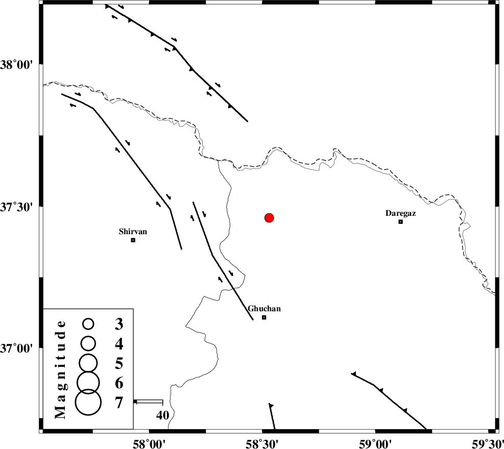
| Location | Lat:37.46 Lon: 58.53 |
| Region | Khorasan(center) Province, 39 km North of Quchan |
Nearest Cities |
|
| 8 km North of Emamqoli, Khorasan(center) Province | |
| 19 km South of Bajgiran, Khorasan(center) Province | |
| 30 km North East of Yatnakanlu, Khorasan(center) Province | |
| 34 km North of Mazraj, Khorasan(center) Province | |
| 37 km West of Borj ghaleh, Khorasan(center) Province | |
| Depth | 14 km |
| Agency | |
Faults within 150 km: |
|
| GHUCHAN_F (Length: 50 km) , Distance to epicenter: 27 km | |
| BAGHAN_GERMAB_F (Length: 79 km) , Distance to epicenter: 36 km | |
| MAIN_KOPEHDAGH_F3 (Length: 96 km) , Distance to epicenter: 38 km | |
| Number of Phases | 5 |
| RMS | 0 |
| Number of Stations | 3 |
| Error in Latitude | >4.9 km |
| Error in Longitude | 4.3 km |
| Error in Depth | 5.7 km |
Download waveform in seisan format
to download seisan software Click here
to access information about IIEES stations Click here
Amplitude | ||||||||
| UID | Agency | Station | Component | Amplitude | Period | Arrival Time | Proccessing Time | Signal Clip |
| 82735 | IIEES | BJRD | E | 110.3 | 0.24 | 2012-04-13 00:08:45 | 2012-04-13 01:03:00 | n |
| 82736 | IIEES | MRVT | E | 58.6 | 0.28 | 2012-04-13 00:09:17 | 2012-04-13 01:03:00 | n |
| 82737 | IIEES | MRVT | N | 58.9 | 0.28 | 2012-04-13 00:09:18 | 2012-04-13 01:03:00 | n |
Phase | ||||||||||||
| Agency | Station | Component | Phase Type | Phase Quality | First Motion | Observed Arrival Time | Time Residual | Loc. Flag | Input Weight | Distance | Azimuth | |
| IIEES | BJRD | N | Pg | E | 2012-04-13 00:08:27 | -0.04 | y | 102 | 286 | |||
| IIEES | BJRD | N | Sg | E | 2012-04-13 00:08:40 | 0 | y | 102 | 286 | |||
| IIEES | MRVT | Z | Pn | E | 2012-04-13 00:08:44 | 0.05 | y | 217 | 277 | |||
| IIEES | MRVT | N | Sg | E | 2012-04-13 00:09:11 | 0.01 | y | 217 | 277 | |||
| IIEES | SHRO | Z | Pn | E | 2012-04-13 00:08:52 | -0.02 | y | 276 | 235 | |||