
Magnitude |
:3.4 |
| Date & Time (UTC) | 2012-04-12 16:47:45.1 |
| Date & Time (Local) | 1391/1/24 21:17:45.1 |
| Location | Lat:30.41 Lon: 50.62 |
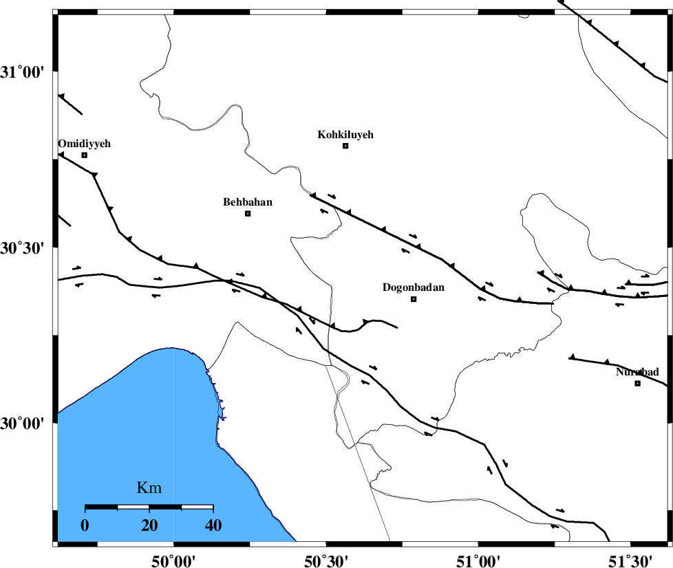
| Region | Kohkiluieh va boyerahmad Province, 18 km West of Dogonbadan |
Nearest Cities |
|
| 17 km North West of Dogonbadan, Kohkiluieh va boyerahmad Province | |
| 39 km South East of Mansuriyeh, Khoozestan Province | |
| 40 km North East of Sardasht, Khoozestan Province | |
| 41 km West of Abdehgah, Kohkiluieh va boyerahmad Province | |
| 42 km South East of Behbahan, Khoozestan Province | |
| Depth | 15 km |
| Agency | |
Faults within 150 km: |
|
| MISHAN_F (Length: 76 km) , Distance to epicenter: 14 km | |
| ZFF3 (Length: 125 km) , Distance to epicenter: 38 km | |
| RAG_E_SEFID_F (Length: 84 km) , Distance to epicenter: 38 km | |
| Number of Phases | 6 |
| RMS | 0.4 |
| Number of Stations | 7 |
| Error in Latitude | >6.1 km |
| Error in Longitude | 3.5 km |
| Error in Depth | 0 km |
Download waveform in seisan format
to download seisan software Click here
to access information about IIEES stations Click here
Amplitude | ||||||||
| UID | Agency | Station | Component | Amplitude | Period | Arrival Time | Proccessing Time | Signal Clip |
| 82724 | IIEES | AHRM | E | 306.8 | 0.4 | 2012-04-12 16:48:47 | 2012-04-12 05:14:00 | n |
| 82725 | IIEES | SHGR | E | 349.2 | 0.52 | 2012-04-12 16:49:09 | 2012-04-12 05:14:00 | n |
| 82726 | IIEES | SHGR | N | 259.5 | 0.64 | 2012-04-12 16:49:13 | 2012-04-12 05:14:00 | n |
| 82727 | IIEES | GHIR | N | 82.3 | 0.48 | 2012-04-12 16:49:28 | 2012-04-12 05:14:00 | n |
| 82728 | IIEES | GHIR | E | 85.2 | 0.56 | 2012-04-12 16:49:33 | 2012-04-12 05:14:00 | n |
| 82729 | IIEES | KHMZ | E | 76.8 | 0.4 | 2012-04-12 16:49:23 | 2012-04-12 05:14:00 | n |
Phase | ||||||||||||
| Agency | Station | Component | Phase Type | Phase Quality | First Motion | Observed Arrival Time | Time Residual | Loc. Flag | Input Weight | Distance | Azimuth | |
| IIEES | SHGR | N | Pn | E | 2012-04-12 16:48:24 | 0.36 | y | 255 | 318 | |||
| IIEES | GHIR | Z | Pn | E | 2012-04-12 16:48:33 | -0.02 | y | 330 | 135 | |||
| IIEES | KHMZ | Z | Pn | E | 2012-04-12 16:48:39 | 0.01 | y | 374 | 351 | |||
| IIEES | GHVR | Z | Pn | E | 2012-04-12 16:48:49 | 0.14 | y | 455 | 7 | |||
| IIEES | ASAO | Z | Pn | E | 2012-04-12 16:48:50 | 0.06 | y | 462 | 353 | |||
| IIEES | SNGE | Z | Pn | E | 2012-04-12 16:49:06 | -0.91 | y | 602 | 330 | |||