
Magnitude |
:2.8 |
| Date & Time (UTC) | 2012-04-11 10:39:28.9 |
| Date & Time (Local) | 1391/1/23 15:09:28.9 |
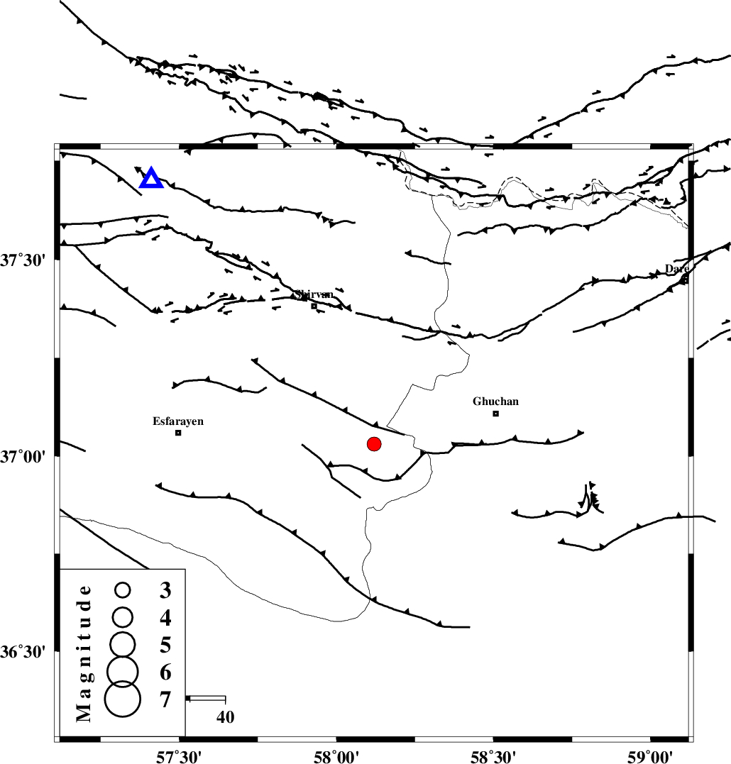
| Location | Lat:37.03 Lon: 58.12 |
| Region | Khorasan(center) Province, 36 km West of Quchan |
Nearest Cities |
|
| 15 km South of Chari, Khorasan(center) Province | |
| 16 km North West of Yangi qaleh, Khorasan(center) Province | |
| 20 km North East of Bam, Khorasan(north) Province | |
| 21 km South of Maviyan, Khorasan(center) Province | |
| 23 km South West of Faruj, Khorasan(center) Province | |
| Depth | 14 km |
| Agency | |
Faults within 150 km: |
|
| ESFARAYEN_F (Length: 111 km) , Distance to epicenter: 26 km | |
| GHUCHAN_F (Length: 50 km) , Distance to epicenter: 31 km | |
| BAGHAN_GERMAB_F (Length: 79 km) , Distance to epicenter: 35 km | |
| Number of Phases | 5 |
| RMS | 0 |
| Number of Stations | 4 |
| Error in Latitude | >3 km |
| Error in Longitude | 3.4 km |
| Error in Depth | 5.4 km |
Download waveform in seisan format
to download seisan software Click here
to access information about IIEES stations Click here
Amplitude | ||||||||
| UID | Agency | Station | Component | Amplitude | Period | Arrival Time | Proccessing Time | Signal Clip |
| 82713 | IIEES | BJRD | E | 265.5 | 0.4 | 2012-04-11 10:40:00 | 2012-04-11 11:01:00 | n |
| 82714 | IIEES | BJRD | N | 196 | 0.28 | 2012-04-11 10:40:01 | 2012-04-11 11:01:00 | n |
| 82715 | IIEES | MRVT | E | 137.9 | 0.66 | 2012-04-11 10:40:25 | 2012-04-11 11:01:00 | n |
| 82716 | IIEES | MRVT | N | 110.2 | 0.41 | 2012-04-11 10:40:28 | 2012-04-11 11:01:00 | n |
Phase | ||||||||||||
| Agency | Station | Component | Phase Type | Phase Quality | First Motion | Observed Arrival Time | Time Residual | Loc. Flag | Input Weight | Distance | Azimuth | |
| IIEES | BJRD | Z | Pg | E | 2012-04-11 10:39:45 | -0.03 | y | 97.3 | 320 | |||
| IIEES | MRVT | Z | Pn | E | 2012-04-11 10:40:00 | 0.06 | y | 193 | 292 | |||
| IIEES | MRVT | N | Sg | E | 2012-04-11 10:40:23 | 0.01 | y | 193 | 292 | |||
| IIEES | SHRO | Z | Pn | E | 2012-04-11 10:40:03 | -0.06 | y | 220 | 240 | |||
| IIEES | TABS | Z | Pn | E | 2012-04-11 10:40:24 | 0.04 | y | 386 | 194 | |||