
Magnitude |
:2 |
| Date & Time (UTC) | 2012-04-08 17:36:36.3 |
| Date & Time (Local) | 1391/1/20 22:06:36.3 |
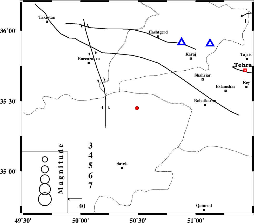
| Location | Lat:35.45 Lon: 50.49 |
| Region | Markazi Province, 48 km North-East of Saveh |
Nearest Cities |
|
| 9 km North of Zaviyeh, Markazi Province | |
| 12 km North of Hakimabad, Markazi Province | |
| 15 km North East of Khoshkrud, Markazi Province | |
| 17 km North of Memunieh, Markazi Province | |
| 20 km North West of Rahimabad, Markazi Province | |
| Depth | 18 km |
| Agency | |
Faults within 150 km: |
|
| S_PARANDAK_F (Length: 116 km) , Distance to epicenter: 13 km | |
| IPAK_F (Length: 80 km) , Distance to epicenter: 22 km | |
| KUSHK_E_NOSRAT_F (Length: 230 km) , Distance to epicenter: 31 km | |
| Number of Phases | 6 |
| RMS | 0.1 |
| Number of Stations | 4 |
| Error in Latitude | >1.9 km |
| Error in Longitude | 4.6 km |
| Error in Depth | 4.4 km |
Download waveform in seisan format
to download seisan software Click here
to access information about IIEES stations Click here
Amplitude | ||||||||
| UID | Agency | Station | Component | Amplitude | Period | Arrival Time | Proccessing Time | Signal Clip |
| 82682 | IIEES | THKV | E | 163.9 | 0.12 | 2012-04-08 17:36:57 | 2012-04-08 06:47:00 | n |
| 82683 | IIEES | GHVR | N | 16.5 | 0.16 | 2012-04-08 17:37:15 | 2012-04-08 06:47:00 | n |
| 82684 | IIEES | GHVR | E | 24.6 | 0.24 | 2012-04-08 17:37:19 | 2012-04-08 06:47:00 | n |
Phase | ||||||||||||
| Agency | Station | Component | Phase Type | Phase Quality | First Motion | Observed Arrival Time | Time Residual | Loc. Flag | Input Weight | Distance | Azimuth | |
| IIEES | THKV | Z | Pg | E | 2012-04-08 17:36:47 | 0.13 | y | 63 | 34 | |||
| IIEES | CHTH | Z | Pg | E | 2012-04-08 17:36:49 | -0.02 | y | 77.3 | 48 | |||
| IIEES | CHTH | N | Sg | E | 2012-04-08 17:36:59 | -0.13 | y | 77.3 | 48 | |||
| IIEES | GHVR | Z | Pg | E | 2012-04-08 17:36:57 | 0.1 | y | 128 | 147 | |||
| IIEES | KHMZ | Z | Pn | E | 2012-04-08 17:37:08 | -0.01 | y | 195 | 194 | |||
| IIEES | KHMZ | N | Sg | E | 2012-04-08 17:37:32 | -0.08 | y | 195 | 194 | |||