
Magnitude |
:2.5 |
| Date & Time (UTC) | 2012-04-03 15:48:59.4 |
| Date & Time (Local) | 1391/1/15 20:18:59.4 |
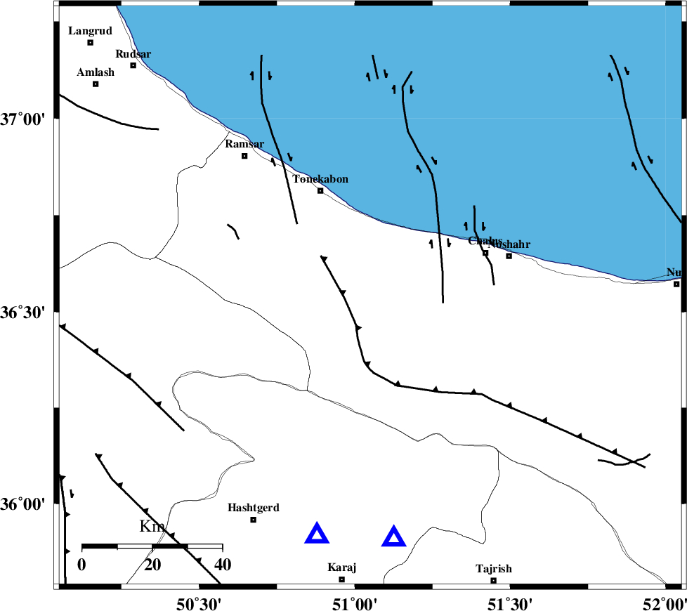
| Location | Lat:36.54 Lon: 51.05 |
| Region | Mazandaran Province, 33 km South-East of Tonekabon |
Nearest Cities |
|
| 16 km North West of Kardichal, Mazandaran Province | |
| 19 km North West of Goyter, Mazandaran Province | |
| 21 km South of Abbasabad, Mazandaran Province | |
| 22 km South of Kanza, Mazandaran Province | |
| 22 km North West of Marzanabad, Mazandaran Province | |
| Depth | 16 km |
| Agency | |
Faults within 150 km: |
|
| N_ALBORZ_F (Length: 360 km) , Distance to epicenter: 13 km | |
| KHAZAR_F (Length: 523 km) , Distance to epicenter: 18 km | |
| BONAN_F (Length: 74 km) , Distance to epicenter: 24 km | |
| Number of Phases | 5 |
| RMS | 0.1 |
| Number of Stations | 3 |
| Error in Latitude | >6.3 km |
| Error in Longitude | 6.5 km |
| Error in Depth | 8.1 km |
Download waveform in seisan format
to download seisan software Click here
to access information about IIEES stations Click here
Amplitude | ||||||||
| UID | Agency | Station | Component | Amplitude | Period | Arrival Time | Proccessing Time | Signal Clip |
| 82634 | IIEES | THKV | E | 234.5 | 0.52 | 2012-04-03 15:49:22 | 2012-04-03 04:16:00 | n |
| 82635 | IIEES | ZNJK | N | 33 | 0.48 | 2012-04-03 15:50:00 | 2012-04-03 04:16:00 | n |
Phase | ||||||||||||
| Agency | Station | Component | Phase Type | Phase Quality | First Motion | Observed Arrival Time | Time Residual | Loc. Flag | Input Weight | Distance | Azimuth | |
| IIEES | CHTH | Z | Pg | E | 2012-04-03 15:49:11 | -0.14 | y | 70.7 | 175 | |||
| IIEES | CHTH | N | Sg | E | 2012-04-03 15:49:21 | -0.07 | y | 70.7 | 175 | |||
| IIEES | THKV | Z | Pg | E | 2012-04-03 15:49:12 | 0.26 | y | 71.3 | 193 | |||
| IIEES | ZNJK | Z | P | E | 2012-04-03 15:49:33 | 0 | y | 212 | 275 | |||
| IIEES | ZNJK | N | Sg | E | 2012-04-03 15:49:59 | -0.05 | y | 212 | 275 | |||