
Magnitude |
:2.7 |
| Date & Time (UTC) | 2012-03-30 02:28:07.0 |
| Date & Time (Local) | 1391/1/11 06:58:07.0 |
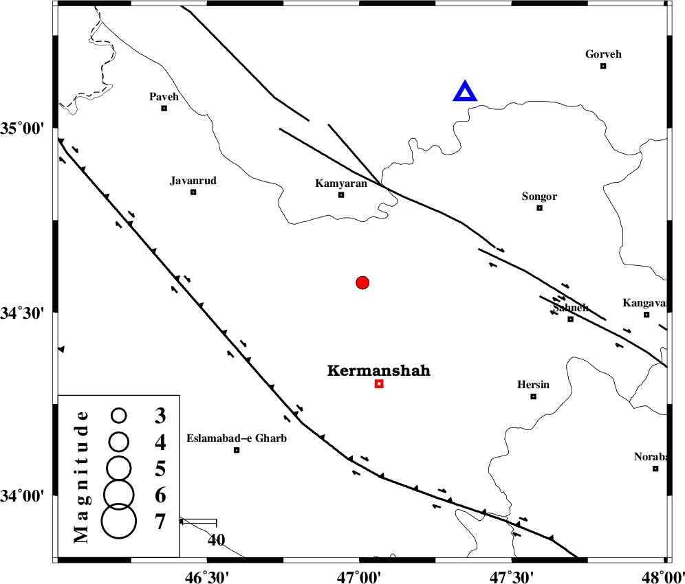
| Location | Lat:34.58 Lon: 47.01 |
| Region | Kermanshah Province, 27 km South of Kamyaran |
Nearest Cities |
|
| 11 km North of Qazanchi, Kermanshah Province | |
| 16 km South of Marzbani, Kermanshah Province | |
| 22 km South East of Qaleh, Kermanshah Province | |
| 22 km West of Kanduleh, Kermanshah Province | |
| 23 km South of Shirvaneh, Kurdistan Province | |
| Depth | 14 km |
| Agency | |
Faults within 150 km: |
|
| SARTAKHT_F (Length: 78 km) , Distance to epicenter: 29 km | |
| MORVARID_F (Length: 24 km) , Distance to epicenter: 30 km | |
| DINEHVAR_F (Length: 46 km) , Distance to epicenter: 36 km | |
| Number of Phases | 6 |
| RMS | 0.2 |
| Number of Stations | 3 |
| Error in Latitude | >4.3 km |
| Error in Longitude | 7.7 km |
| Error in Depth | 9.6 km |
Download waveform in seisan format
to download seisan software Click here
to access information about IIEES stations Click here
Amplitude | ||||||||
| UID | Agency | Station | Component | Amplitude | Period | Arrival Time | Proccessing Time | Signal Clip |
| 82596 | IIEES | SNGE | N | 555.2 | 0.28 | 2012-03-30 02:28:29 | 2012-03-31 12:26:00 | n |
| 82597 | IIEES | SNGE | E | 333.2 | 0.24 | 2012-03-30 02:28:30 | 2012-03-31 12:26:00 | n |
| 82598 | IIEES | ASAO | E | 30 | 0.52 | 2012-03-30 02:29:34 | 2012-03-31 12:26:00 | n |
| 82599 | IIEES | KHMZ | E | 32.7 | 0.44 | 2012-03-30 02:29:37 | 2012-03-31 12:26:00 | n |
| 82600 | IIEES | KHMZ | N | 26 | 0.6 | 2012-03-30 02:29:40 | 2012-03-31 12:26:00 | n |
Phase | ||||||||||||
| Agency | Station | Component | Phase Type | Phase Quality | First Motion | Observed Arrival Time | Time Residual | Loc. Flag | Input Weight | Distance | Azimuth | |
| IIEES | SNGE | Z | Pg | E | 2012-03-30 02:28:18 | -0.34 | y | 64.5 | 29 | |||
| IIEES | SNGE | N | Sg | E | 2012-03-30 02:28:27 | 0.15 | y | 64.5 | 29 | |||
| IIEES | ASAO | Z | Pn | E | 2012-03-30 02:28:49 | 0.38 | y | 277 | 90 | |||
| IIEES | ASAO | N | Sg | E | 2012-03-30 02:29:25 | 0 | y | 277 | 90 | |||
| IIEES | KHMZ | Z | Pn | E | 2012-03-30 02:28:50 | -0.04 | y | 288 | 108 | |||
| IIEES | KHMZ | E | Sg | E | 2012-03-30 02:29:28 | -0.13 | y | 288 | 108 | |||