
Magnitude |
:2.9 |
| Date & Time (UTC) | 2012-03-29 10:12:38.7 |
| Date & Time (Local) | 1391/1/10 14:42:38.7 |
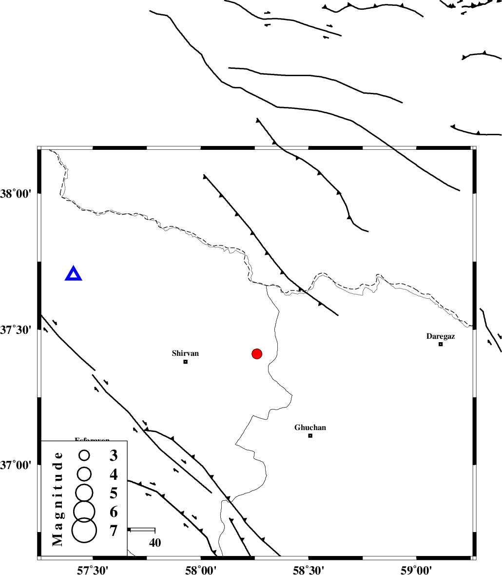
| Location | Lat:37.41 Lon: 58.26 |
| Region | Khorasan(center) Province, 29 km East of Shirvan |
Nearest Cities |
|
| 16 km North of Yatnakanlu, Khorasan(center) Province | |
| 21 km South East of Haname-ye bozorg, Khorasan(north) Province | |
| 22 km North of Faruj, Khorasan(center) Province | |
| 22 km North East of Amirabad, Khorasan(north) Province | |
| 24 km North West of Emamqoli, Khorasan(center) Province | |
| Depth | 15 km |
| Agency | |
Faults within 150 km: |
|
| GHUCHAN_F (Length: 50 km) , Distance to epicenter: 9 km | |
| BAGHAN_GERMAB_F (Length: 79 km) , Distance to epicenter: 12 km | |
| MAIN_KOPEHDAGH_F3 (Length: 96 km) , Distance to epicenter: 46 km | |
| Number of Phases | 6 |
| RMS | 0.1 |
| Number of Stations | 5 |
| Error in Latitude | >9.4 km |
| Error in Longitude | 3.5 km |
| Error in Depth | 12.9 km |
Download waveform in seisan format
to download seisan software Click here
to access information about IIEES stations Click here
Amplitude | ||||||||
| UID | Agency | Station | Component | Amplitude | Period | Arrival Time | Proccessing Time | Signal Clip |
| 82590 | IIEES | MRVT | N | 144.6 | 0.5 | 2012-03-29 10:13:37 | 2012-03-29 10:36:00 | n |
| 82591 | IIEES | SHRO | N | 56.1 | 0.62 | 2012-03-29 10:13:52 | 2012-03-29 10:36:00 | n |
Phase | ||||||||||||
| Agency | Station | Component | Phase Type | Phase Quality | First Motion | Observed Arrival Time | Time Residual | Loc. Flag | Input Weight | Distance | Azimuth | |
| IIEES | BJRD | Z | Pg | E | 2012-03-29 10:12:52 | 0.04 | y | 81.9 | 293 | |||
| IIEES | MRVT | Z | Pg | E | 2012-03-29 10:13:10 | -0.15 | y | 194 | 279 | |||
| IIEES | MRVT | N | Sg | E | 2012-03-29 10:13:33 | 0.1 | y | 194 | 279 | |||
| IIEES | SHRO | Z | Pn | E | 2012-03-29 10:13:17 | -0.08 | y | 254 | 233 | |||
| IIEES | TABS | Z | Pn | E | 2012-03-29 10:13:39 | 0.02 | y | 430 | 194 | |||
| IIEES | SHRT | Z | Pn | E | 2012-03-29 10:13:43 | 0.1 | y | 456 | 156 | |||