
Magnitude |
:3 |
| Date & Time (UTC) | 2012-03-24 02:31:14.8 |
| Date & Time (Local) | 1391/1/5 07:01:14.8 |
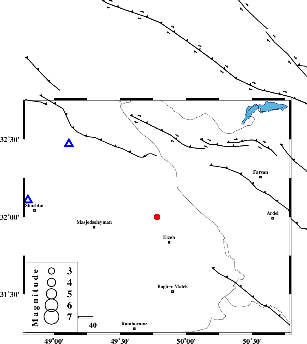
| Location | Lat:32 Lon: 49.78 |
| Region | Khoozestan Province, 20 km North of Izeh |
Nearest Cities |
|
| 4 km of Torshak, Khoozestan Province | |
| 15 km North of Rasvand, Khoozestan Province | |
| 20 km North of Izeh, Khoozestan Province | |
| 24 km North of Chenarestan, Khoozestan Province | |
| 38 km South East of Paabshalal, Khoozestan Province | |
| Depth | 14 km |
| Agency | |
Faults within 150 km: |
|
| MFF2 (Length: 205 km) , Distance to epicenter: 4 km | |
| ZARDKUH_F (Length: 139 km) , Distance to epicenter: 41 km | |
| DOPOLAN_F (Length: 107 km) , Distance to epicenter: 44 km | |
| Number of Phases | 6 |
| RMS | 0.1 |
| Number of Stations | 5 |
| Error in Latitude | >2.2 km |
| Error in Longitude | 3.2 km |
| Error in Depth | 4.8 km |
Download waveform in seisan format
to download seisan software Click here
to access information about IIEES stations Click here
Amplitude | ||||||||
| UID | Agency | Station | Component | Amplitude | Period | Arrival Time | Proccessing Time | Signal Clip |
| 82509 | IIEES | SHGR | E | 370.6 | 0.52 | 2012-03-24 02:31:47 | 2012-03-24 01:40:00 | n |
| 82510 | IIEES | GHVR | N | 73.7 | 1 | 2012-03-24 02:32:50 | 2012-03-24 01:40:00 | n |
Phase | ||||||||||||
| Agency | Station | Component | Phase Type | Phase Quality | First Motion | Observed Arrival Time | Time Residual | Loc. Flag | Input Weight | Distance | Azimuth | |
| IIEES | SHGR | Z | Pg | E | 2012-03-24 02:31:30 | -0.01 | y | 93.2 | 278 | |||
| IIEES | KHMZ | Z | Pn | E | 2012-03-24 02:31:46 | -0.09 | y | 194 | 5 | |||
| IIEES | KHMZ | E | Sg | E | 2012-03-24 02:32:10 | -0.03 | y | 194 | 5 | |||
| IIEES | ASAO | Z | Pn | E | 2012-03-24 02:31:58 | 0.11 | y | 284 | 5 | |||
| IIEES | NASN | Z | Pn | E | 2012-03-24 02:31:59 | -0.05 | y | 298 | 72 | |||
| IIEES | GHVR | Z | Pn | E | 2012-03-24 02:32:00 | 0.08 | y | 307 | 26 | |||