
Magnitude |
:2.6 |
| Date & Time (UTC) | 2012-03-22 08:00:45.5 |
| Date & Time (Local) | 1391/1/3 12:30:45.5 |
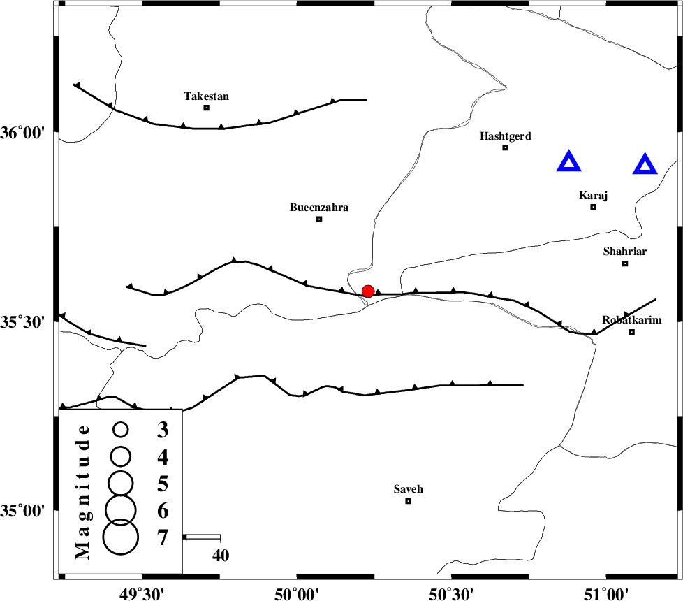
| Location | Lat:35.58 Lon: 50.23 |
| Region | Tehran Province, 26 km South-East of Buinzara |
Nearest Cities |
|
| 23 km North West of Khoshkrud, Markazi Province | |
| 23 km South West of Eshtehard, Tehran Province | |
| 25 km South East of Buinzara, Ghazvin Province | |
| 33 km South East of Sagezabad, Ghazvin Province | |
| 37 km North West of Zaviyeh, Markazi Province | |
| Depth | 15 km |
| Agency | |
Faults within 150 km: |
|
| IPAK_F (Length: 80 km) , Distance to epicenter: 12 km | |
| S_PARANDAK_F (Length: 116 km) , Distance to epicenter: 20 km | |
| ESHTEHARD_F (Length: 69 km) , Distance to epicenter: 21 km | |
| Number of Phases | 6 |
| RMS | 0.2 |
| Number of Stations | 6 |
| Error in Latitude | >4.5 km |
| Error in Longitude | 8.2 km |
| Error in Depth | 8.3 km |
Download waveform in seisan format
to download seisan software Click here
to access information about IIEES stations Click here
Amplitude | ||||||||
| UID | Agency | Station | Component | Amplitude | Period | Arrival Time | Proccessing Time | Signal Clip |
| 82463 | IIEES | GHVR | E | 97 | 0.4 | 2012-03-22 08:01:35 | 2012-03-22 07:39:00 | n |
Phase | ||||||||||||
| Agency | Station | Component | Phase Type | Phase Quality | First Motion | Observed Arrival Time | Time Residual | Loc. Flag | Input Weight | Distance | Azimuth | |
| IIEES | THKV | Z | Pg | E | 2012-03-22 08:00:58 | 0.31 | y | 69.8 | 57 | |||
| IIEES | CHTH | Z | Pg | E | 2012-03-22 08:01:00 | -0.17 | y | 89.2 | 66 | |||
| IIEES | ASAO | Z | Pg | E | 2012-03-22 08:01:05 | -0.11 | y | 116 | 189 | |||
| IIEES | GHVR | Z | Pg | E | 2012-03-22 08:01:11 | 0.24 | y | 153 | 142 | |||
| IIEES | DAMV | Z | Pg | E | 2012-03-22 08:01:11 | -0.27 | y | 158 | 87 | |||
| IIEES | KHMZ | Z | Pn | E | 2012-03-22 08:01:18 | 0 | y | 205 | 187 | |||