
Magnitude |
:3.2 |
| Date & Time (UTC) | 2012-03-19 07:06:09.0 |
| Date & Time (Local) | 1390/12/29 10:36:09.0 |
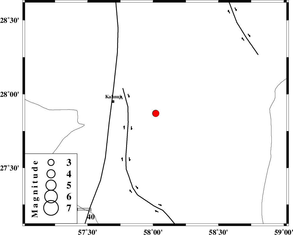
| Location | Lat:27.87 Lon: 58.02 |
| Region | Kerman Province, 34 km East of Kahnuj |
Nearest Cities |
|
| 33 km East of Kahnuj, Kerman Province | |
| 41 km North East of Qalehy-eganj, Kerman Province | |
| 44 km North East of Bargah, Kerman Province | |
| 52 km South West of Borj-e abbasabad, Kerman Province | |
| 55 km South West of Mardehak, Kerman Province | |
| Depth | 14 km |
| Agency | |
Faults within 150 km: |
|
| JIROFT_F (Length: 144 km) , Distance to epicenter: 21 km | |
| SABZEVARAN_F (Length: 190 km) , Distance to epicenter: 36 km | |
| BAM_F (Length: 118 km) , Distance to epicenter: 89 km | |
| Number of Phases | 5 |
| RMS | 0.1 |
| Number of Stations | 4 |
| Error in Latitude | >2.6 km |
| Error in Longitude | 2.4 km |
| Error in Depth | 7.7 km |
Download waveform in seisan format
to download seisan software Click here
to access information about IIEES stations Click here
Amplitude | ||||||||
| UID | Agency | Station | Component | Amplitude | Period | Arrival Time | Proccessing Time | Signal Clip |
| 82417 | IIEES | BNDS | N | 139.6 | 0.4 | 2012-03-19 07:07:04 | 2012-03-19 10:49:00 | n |
| 82418 | IIEES | BNDS | E | 186.7 | 0.32 | 2012-03-19 07:07:06 | 2012-03-19 10:49:00 | n |
| 82419 | IIEES | CHBR | E | 87.8 | 0.4 | 2012-03-19 07:07:36 | 2012-03-19 10:49:00 | n |
| 82420 | IIEES | CHBR | N | 128.2 | 0.24 | 2012-03-19 07:07:37 | 2012-03-19 10:49:00 | n |
Phase | ||||||||||||
| Agency | Station | Component | Phase Type | Phase Quality | First Motion | Observed Arrival Time | Time Residual | Loc. Flag | Input Weight | Distance | Azimuth | |
| IIEES | BNDS | Z | Pn | E | 2012-03-19 07:06:40 | 0.07 | y | 190 | 255 | |||
| IIEES | BNDS | E | Sg | E | 2012-03-19 07:07:03 | -0.08 | y | 190 | 255 | |||
| IIEES | KRBR | Z | Pn | E | 2012-03-19 07:06:49 | 0.1 | y | 265 | 333 | |||
| IIEES | ZHSF | Z | P | E | 2012-03-19 07:06:57 | -0.16 | y | 331 | 54 | |||
| IIEES | CHBR | Z | P | E | 2012-03-19 07:07:00 | 0.07 | y | 351 | 135 | |||