
Magnitude |
:3 |
| Date & Time (UTC) | 2012-03-19 04:29:55.1 |
| Date & Time (Local) | 1390/12/29 07:59:55.1 |
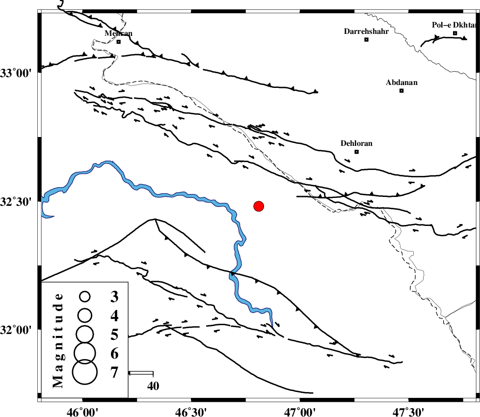
| Location | Lat:32.48 Lon: 46.81 |
| Region | Iraq, 48 km South-West of Dehloran |
Nearest Cities |
|
| 41 km South West of Bishehzar, Ilam Province | |
| 48 km South West of Dehloran, Ilam Province | |
| 52 km West of Musian, Ilam Province | |
| 79 km South West of Abdanan, Ilam Province | |
| 84 km South West of Meymeh, Ilam Province | |
| Depth | 18 km |
| Agency | |
Faults within 150 km: |
|
| MFF6 (Length: 144 km) , Distance to epicenter: 42 km | |
| BALARUD_F_Z1 (Length: 87 km) , Distance to epicenter: 79 km | |
| ZFF4 (Length: 128 km) , Distance to epicenter: 82 km | |
| Number of Phases | 6 |
| RMS | 0.1 |
| Number of Stations | 4 |
| Error in Latitude | >2.4 km |
| Error in Longitude | 4.7 km |
| Error in Depth | 6.2 km |
Download waveform in seisan format
to download seisan software Click here
to access information about IIEES stations Click here
Amplitude | ||||||||
| UID | Agency | Station | Component | Amplitude | Period | Arrival Time | Proccessing Time | Signal Clip |
| 82412 | IIEES | SHGR | E | 134.2 | 0.48 | 2012-03-19 04:30:54 | 2012-03-19 03:48:00 | n |
| 82413 | IIEES | SHGR | N | 155.5 | 0.52 | 2012-03-19 04:31:11 | 2012-03-19 03:48:00 | n |
| 82414 | IIEES | SNGE | N | 76.7 | 0.52 | 2012-03-19 04:31:23 | 2012-03-19 03:48:00 | n |
| 82415 | IIEES | SNGE | E | 78.5 | 0.68 | 2012-03-19 04:31:27 | 2012-03-19 03:48:00 | n |
Phase | ||||||||||||
| Agency | Station | Component | Phase Type | Phase Quality | First Motion | Observed Arrival Time | Time Residual | Loc. Flag | Input Weight | Distance | Azimuth | |
| IIEES | SHGR | Z | Pg | E | 2012-03-19 04:30:26 | -0.05 | y | 192 | 102 | |||
| IIEES | SHGR | N | Sg | E | 2012-03-19 04:30:49 | 0.09 | y | 192 | 102 | |||
| IIEES | SNGE | Z | Pn | E | 2012-03-19 04:30:39 | 0.09 | y | 294 | 10 | |||
| IIEES | KHMZ | Z | Pn | E | 2012-03-19 04:30:42 | -0.21 | y | 326 | 64 | |||
| IIEES | ASAO | Z | Pn | E | 2012-03-19 04:30:49 | 0.12 | y | 376 | 52 | |||
| IIEES | ASAO | E | Sg | E | 2012-03-19 04:31:40 | -0.03 | y | 376 | 52 | |||