
Magnitude |
:2.1 |
| Date & Time (UTC) | 2012-03-11 14:55:30.7 |
| Date & Time (Local) | 1390/12/21 18:25:30.7 |
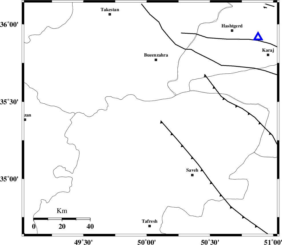
| Location | Lat:35.39 Lon: 50.03 |
| Region | Markazi Province, 42 km South of Buinzara |
Nearest Cities |
|
| 9 km North of Razegian, Markazi Province | |
| 19 km East of Duzaj, Markazi Province | |
| 28 km West of Khoshkrud, Markazi Province | |
| 36 km North East of Gharqabad, Markazi Province | |
| 37 km North of Qeytaniyeh, Markazi Province | |
| Depth | 26 km |
| Agency | |
Faults within 150 km: |
|
| S_PARANDAK_F (Length: 116 km) , Distance to epicenter: 3 km | |
| KUSHK_E_NOSRAT_F (Length: 230 km) , Distance to epicenter: 17 km | |
| INDES_F (Length: 98 km) , Distance to epicenter: 30 km | |
| Number of Phases | 6 |
| RMS | 0.1 |
| Number of Stations | 4 |
| Error in Latitude | >2.5 km |
| Error in Longitude | 5.1 km |
| Error in Depth | 3.2 km |
Download waveform in seisan format
to download seisan software Click here
to access information about IIEES stations Click here
Amplitude | ||||||||
| UID | Agency | Station | Component | Amplitude | Period | Arrival Time | Proccessing Time | Signal Clip |
| 82278 | IIEES | GHVR | N | 50.6 | 1 | 2012-03-11 14:56:20 | 2012-03-11 02:38:00 | n |
| 82279 | IIEES | GHVR | E | 15.5 | 0.24 | 2012-03-11 14:56:22 | 2012-03-11 02:38:00 | n |
| 82280 | IIEES | DAMV | E | 23.1 | 0.76 | 2012-03-11 14:56:24 | 2012-03-11 02:38:00 | n |
Phase | ||||||||||||
| Agency | Station | Component | Phase Type | Phase Quality | First Motion | Observed Arrival Time | Time Residual | Loc. Flag | Input Weight | Distance | Azimuth | |
| IIEES | ASAO | Z | Pg | E | 2012-03-11 14:55:46 | -0.04 | y | 93.8 | 180 | |||
| IIEES | ASAO | E | Sg | E | 2012-03-11 14:55:58 | -0.03 | y | 93.8 | 180 | |||
| IIEES | CHTH | Z | Pg | E | 2012-03-11 14:55:50 | 0.08 | y | 115 | 60 | |||
| IIEES | CHTH | E | Sg | E | 2012-03-11 14:56:03 | -0.08 | y | 115 | 60 | |||
| IIEES | GHVR | Z | Pg | E | 2012-03-11 14:55:55 | 0.09 | y | 150 | 132 | |||
| IIEES | DAMV | Z | Pn | E | 2012-03-11 14:55:59 | -0.02 | y | 178 | 81 | |||