
Magnitude |
:4 |
| Date & Time (UTC) | 2012-03-10 21:41:05.8 |
| Date & Time (Local) | 1390/12/21 01:11:05.8 |
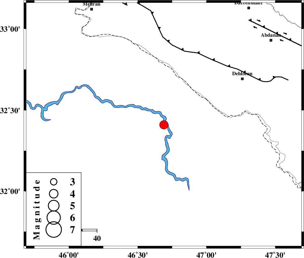
| Location | Lat:32.41 Lon: 46.69 |
| Region | Iraq, 62 km South-West of Dehloran |
Nearest Cities |
|
| 53 km South West of Bishehzar, Ilam Province | |
| 62 km South West of Dehloran, Ilam Province | |
| 65 km South West of Musian, Ilam Province | |
| 93 km South East of Mehran, Ilam Province | |
| 93 km South West of Abdanan, Ilam Province | |
| Depth | 46 km |
| Agency | |
Faults within 150 km: |
|
| MFF6 (Length: 144 km) , Distance to epicenter: 52 km | |
| ZFF4 (Length: 128 km) , Distance to epicenter: 85 km | |
| BALARUD_F_Z1 (Length: 87 km) , Distance to epicenter: 92 km | |
| Number of Phases | 7 |
| RMS | 0.3 |
| Number of Stations | 5 |
| Error in Latitude | >12.2 km |
| Error in Longitude | 21.6 km |
| Error in Depth | 14.9 km |
Download waveform in seisan format
to download seisan software Click here
to access information about IIEES stations Click here
Amplitude | ||||||||
| UID | Agency | Station | Component | Amplitude | Period | Arrival Time | Proccessing Time | Signal Clip |
| 82241 | IIEES | SHGR | E | 1627.2 | 0.4 | 2012-03-10 21:42:05 | 2012-03-10 09:05:00 | n |
| 82242 | IIEES | SHGR | N | 1528.3 | 0.68 | 2012-03-10 21:42:19 | 2012-03-10 09:05:00 | n |
| 82243 | IIEES | SNGE | E | 681.9 | 0.6 | 2012-03-10 21:42:34 | 2012-03-10 09:05:00 | n |
| 82244 | IIEES | KHMZ | E | 260.1 | 0.6 | 2012-03-10 21:42:41 | 2012-03-10 09:05:00 | n |
Phase | ||||||||||||
| Agency | Station | Component | Phase Type | Phase Quality | First Motion | Observed Arrival Time | Time Residual | Loc. Flag | Input Weight | Distance | Azimuth | |
| IIEES | SHGR | Z | P | E | 2012-03-10 21:41:36 | 0.54 | y | 202 | 99 | |||
| IIEES | SHGR | N | Sg | E | 2012-03-10 21:42:02 | -0.12 | y | 202 | 99 | |||
| IIEES | SNGE | Z | Pn | E | 2012-03-10 21:41:48 | -0.29 | y | 304 | 11 | |||
| IIEES | SNGE | N | Sg | E | 2012-03-10 21:42:30 | 0.27 | y | 304 | 11 | |||
| IIEES | KHMZ | Z | Pn | E | 2012-03-10 21:41:52 | -0.2 | y | 340 | 63 | |||
| IIEES | ASAO | Z | Pn | E | 2012-03-10 21:41:59 | -0.29 | y | 391 | 52 | |||
| IIEES | GHVR | Z | Pn | E | 2012-03-10 21:42:10 | -0.01 | y | 482 | 60 | |||