
Magnitude |
:3.2 |
| Date & Time (UTC) | 2012-03-10 15:15:44.1 |
| Date & Time (Local) | 1390/12/20 18:45:44.1 |
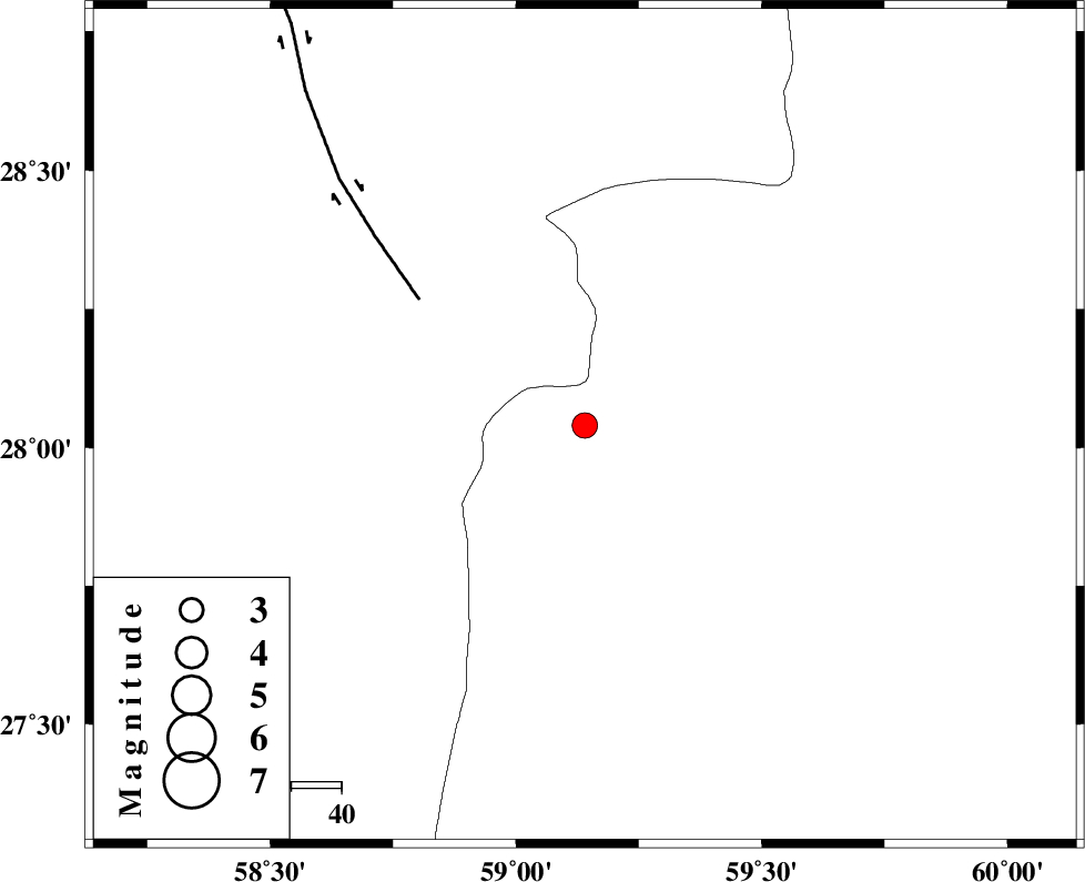
| Location | Lat:28.04 Lon: 59.14 |
| Region | Sistan va Baloochestan Province, 142 km East of Kahnuj |
Nearest Cities |
|
| 61 km North East of Borj-e abbasabad, Kerman Province | |
| 71 km North West of Kalemursi, Sistan va Baloochestan Province | |
| 74 km South of Hoseynabad, Kerman Province | |
| 80 km South East of Mohammadabad-e gonbaki, Kerman Province | |
| 95 km South East of Void, Kerman Province | |
| Depth | 15 km |
| Agency | |
Faults within 150 km: |
|
| BAM_F (Length: 118 km) , Distance to epicenter: 42 km | |
| KASKIN_F (Length: 100 km) , Distance to epicenter: 110 km | |
| KANURAK_F (Length: 135 km) , Distance to epicenter: 112 km | |
| Number of Phases | 4 |
| RMS | 0.1 |
| Number of Stations | 4 |
| Error in Latitude | >2 km |
| Error in Longitude | 1.5 km |
| Error in Depth | 0 km |
Download waveform in seisan format
to download seisan software Click here
to access information about IIEES stations Click here
Amplitude | ||||||||
| UID | Agency | Station | Component | Amplitude | Period | Arrival Time | Proccessing Time | Signal Clip |
| 82234 | IIEES | BNDS | E | 93.6 | 0.4 | 2012-03-10 15:17:06 | 2012-03-10 02:26:00 | n |
| 82235 | IIEES | BNDS | N | 109.5 | 0.44 | 2012-03-10 15:17:14 | 2012-03-10 02:26:00 | n |
Phase | ||||||||||||
| Agency | Station | Component | Phase Type | Phase Quality | First Motion | Observed Arrival Time | Time Residual | Loc. Flag | Input Weight | Distance | Azimuth | |
| IIEES | ZHSF | Z | Pn | E | 2012-03-10 15:16:21 | -0.06 | y | 236 | 42 | |||
| IIEES | BNDS | Z | Pn | E | 2012-03-10 15:16:29 | -0.11 | y | 301 | 257 | |||
| IIEES | CHBR | Z | Pn | E | 2012-03-10 15:16:29 | 0.06 | y | 302 | 153 | |||
| IIEES | KRBR | Z | Pn | E | 2012-03-10 15:16:31 | 0.12 | y | 316 | 313 | |||