
Magnitude |
:2 |
| Date & Time (UTC) | 2012-03-03 16:35:03.7 |
| Date & Time (Local) | 1390/12/13 20:05:03.7 |
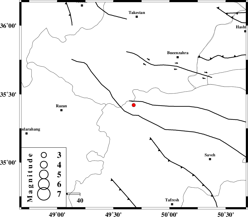
| Location | Lat:35.42 Lon: 49.68 |
| Region | Markazi Province, 71 km South of Takestan |
Nearest Cities |
|
| 13 km North West of Duzaj, Markazi Province | |
| 25 km North East of Yatan, Markazi Province | |
| 27 km North West of Razegian, Markazi Province | |
| 29 km South East of Kolanjin, Ghazvin Province | |
| 34 km North of Nobaran, Markazi Province | |
| Depth | 45 km |
| Agency | |
Faults within 150 km: |
|
| S_PARANDAK_F (Length: 116 km) , Distance to epicenter: 5 km | |
| KUSHK_E_NOSRAT_F (Length: 230 km) , Distance to epicenter: 8 km | |
| INDES_F (Length: 98 km) , Distance to epicenter: 30 km | |
| Number of Phases | 5 |
| RMS | 0.1 |
| Number of Stations | 3 |
| Error in Latitude | >4.1 km |
| Error in Longitude | 11.5 km |
| Error in Depth | 32.2 km |
Download waveform in seisan format
to download seisan software Click here
to access information about IIEES stations Click here
Amplitude | ||||||||
| UID | Agency | Station | Component | Amplitude | Period | Arrival Time | Proccessing Time | Signal Clip |
| 82152 | IIEES | THKV | N | 57.8 | 0.16 | 2012-03-03 16:35:40 | 2012-03-03 04:56:00 | n |
| 82153 | IIEES | THKV | E | 48.6 | 0.2 | 2012-03-03 16:35:46 | 2012-03-03 04:56:00 | n |
| 82154 | IIEES | CHTH | E | 20.2 | 0.36 | 2012-03-03 16:35:47 | 2012-03-03 04:56:00 | n |
| 82155 | IIEES | GHVR | N | 8.1 | 0.4 | 2012-03-03 16:36:03 | 2012-03-03 04:56:00 | n |
| 82156 | IIEES | GHVR | E | 15.9 | 0.24 | 2012-03-03 16:36:07 | 2012-03-03 04:56:00 | n |
Phase | ||||||||||||
| Agency | Station | Component | Phase Type | Phase Quality | First Motion | Observed Arrival Time | Time Residual | Loc. Flag | Input Weight | Distance | Azimuth | |
| IIEES | THKV | Z | Pg | E | 2012-03-03 16:35:24 | -0.11 | y | 121 | 63 | |||
| IIEES | THKV | N | Sg | E | 2012-03-03 16:35:39 | 0.06 | y | 121 | 63 | |||
| IIEES | CHTH | Z | Pg | E | 2012-03-03 16:35:27 | 0.11 | y | 141 | 67 | |||
| IIEES | CHTH | E | Sg | E | 2012-03-03 16:35:44 | -0.06 | y | 141 | 67 | |||
| IIEES | GHVR | Z | Pg | E | 2012-03-03 16:35:32 | 0 | y | 177 | 126 | |||