
Magnitude |
:3.5 |
| Date & Time (UTC) | 2012-02-29 01:35:27.1 |
| Date & Time (Local) | 1390/12/10 05:05:27.1 |
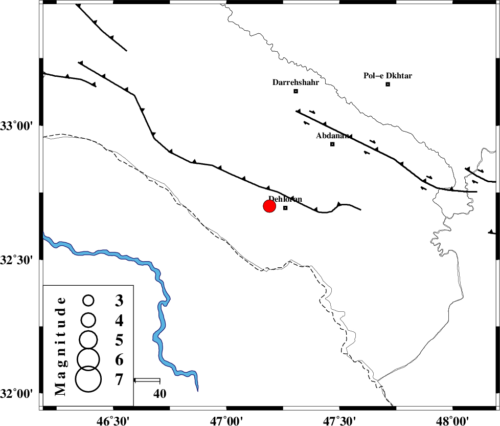
| Location | Lat:32.7 Lon: 47.19 |
| Region | Ilam Province, 7 km Dehloran |
Nearest Cities |
|
| 7 km North of Dehloran, Ilam Province | |
| 23 km North West of Musian, Ilam Province | |
| 24 km South East of Bishehzar, Ilam Province | |
| 36 km South West of Abdanan, Ilam Province | |
| 41 km South West of Sarabbagh, Ilam Province | |
| Depth | 15 km |
| Agency | |
Faults within 150 km: |
|
| MFF6 (Length: 144 km) , Distance to epicenter: 7 km | |
| BALARUD_F_Z1 (Length: 87 km) , Distance to epicenter: 41 km | |
| BALARUD_F_Z3 (Length: 53 km) , Distance to epicenter: 82 km | |
| Number of Phases | 4 |
| RMS | 0 |
| Number of Stations | 4 |
| Error in Latitude | >4.1 km |
| Error in Longitude | 7 km |
| Error in Depth | 999.9 km |
Download waveform in seisan format
to download seisan software Click here
to access information about IIEES stations Click here
Amplitude | ||||||||
| UID | Agency | Station | Component | Amplitude | Period | Arrival Time | Proccessing Time | Signal Clip |
| 82069 | IIEES | SHGR | E | 824 | 0.4 | 2012-02-29 01:36:20 | 2012-02-29 01:03:00 | n |
| 82070 | IIEES | SHGR | N | 539 | 0.4 | 2012-02-29 01:36:23 | 2012-02-29 01:03:00 | n |
Phase | ||||||||||||
| Agency | Station | Component | Phase Type | Phase Quality | First Motion | Observed Arrival Time | Time Residual | Loc. Flag | Input Weight | Distance | Azimuth | |
| IIEES | SHGR | Z | Pn | E | 2012-02-29 01:35:55 | -0.01 | y | 165 | 113 | |||
| IIEES | SNGE | Z | Pn | E | 2012-02-29 01:36:07 | 0.01 | y | 266 | 3 | |||
| IIEES | KHMZ | Z | Pn | E | 2012-02-29 01:36:10 | 0.04 | y | 283 | 65 | |||
| IIEES | ASAO | Z | Pn | E | 2012-02-29 01:36:16 | -0.05 | y | 334 | 51 | |||