
Magnitude |
:3 |
| Date & Time (UTC) | 2012-02-14 01:33:51.1 |
| Date & Time (Local) | 1390/11/25 05:03:51.1 |
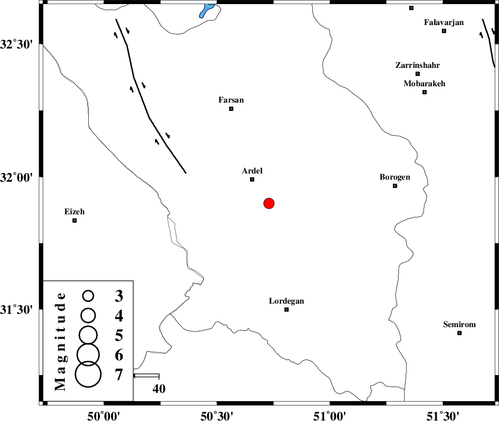
| Location | Lat:31.9 Lon: 50.73 |
| Region | Chaharmahal Bakhtiari Province, 12 km Ardel |
Nearest Cities |
|
| 4 km of Naghan, Chaharmahal Bakhtiari Province | |
| 12 km East of Dupelan, Chaharmahal Bakhtiari Province | |
| 12 km of Ardel, Chaharmahal Bakhtiari Province | |
| 18 km South of Shalamzar, Chaharmahal Bakhtiari Province | |
| 24 km North East of Sarkhun, Chaharmahal Bakhtiari Province | |
| Depth | 14 km |
| Agency | |
Faults within 150 km: |
|
| DOPOLAN_F (Length: 107 km) , Distance to epicenter: 3 km | |
| ARDAL_F (Length: 170 km) , Distance to epicenter: 15 km | |
| SABZKUH_F (Length: 67 km) , Distance to epicenter: 19 km | |
| Number of Phases | 6 |
| RMS | 0.1 |
| Number of Stations | 4 |
| Error in Latitude | >2.8 km |
| Error in Longitude | 2.7 km |
| Error in Depth | 5.2 km |
Download waveform in seisan format
to download seisan software Click here
to access information about IIEES stations Click here
Amplitude | ||||||||
| UID | Agency | Station | Component | Amplitude | Period | Arrival Time | Proccessing Time | Signal Clip |
| 81875 | IIEES | SHGR | N | 209.6 | 0.72 | 2012-02-14 01:34:54 | 2012-02-14 01:52:00 | n |
| 81876 | IIEES | SHGR | E | 179.3 | 0.48 | 2012-02-14 01:34:58 | 2012-02-14 01:52:00 | n |
| 81877 | IIEES | GHVR | E | 56.8 | 0.56 | 2012-02-14 01:35:15 | 2012-02-14 01:52:00 | n |
| 81878 | IIEES | GHVR | N | 57.2 | 0.6 | 2012-02-14 01:35:30 | 2012-02-14 01:52:00 | n |
Phase | ||||||||||||
| Agency | Station | Component | Phase Type | Phase Quality | First Motion | Observed Arrival Time | Time Residual | Loc. Flag | Input Weight | Distance | Azimuth | |
| IIEES | SHGR | Z | Pg | E | 2012-02-14 01:34:21 | -0.07 | y | 183 | 278 | |||
| IIEES | SHGR | N | Sg | E | 2012-02-14 01:34:43 | -0.02 | y | 183 | 278 | |||
| IIEES | NASN | Z | Pn | E | 2012-02-14 01:34:26 | -0.07 | y | 220 | 62 | |||
| IIEES | GHVR | Z | Pn | E | 2012-02-14 01:34:34 | 0.04 | y | 290 | 9 | |||
| IIEES | GHVR | E | Sg | E | 2012-02-14 01:35:12 | -0.09 | y | 290 | 9 | |||
| IIEES | ASAO | Z | Pn | E | 2012-02-14 01:34:36 | 0.23 | y | 301 | 348 | |||