
Magnitude |
:2.6 |
| Date & Time (UTC) | 2012-01-19 11:18:12.2 |
| Date & Time (Local) | 1390/10/29 14:48:12.2 |
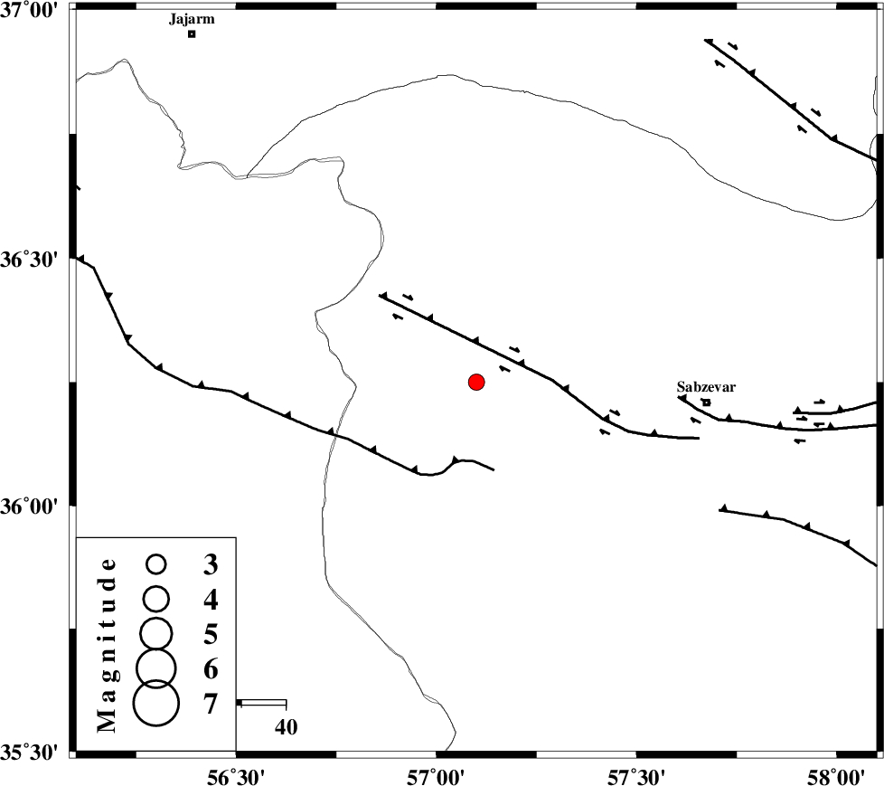
| Location | Lat:36.25 Lon: 57.1 |
| Region | Khorasan(center) Province, 51 km West of Sabzevar |
Nearest Cities |
|
| 7 km of Sadkharu, Khorasan(center) Province | |
| 21 km North West of Rivand, Khorasan(center) Province | |
| 23 km East of Davarzan, Khorasan(center) Province | |
| 40 km South of Abuchenari, Khorasan(center) Province | |
| 42 km South East of Frumad, Semnan Province | |
| Depth | 18 km |
| Agency | |
Faults within 150 km: |
|
| SABZEVAR_F (Length: 81 km) , Distance to epicenter: 20 km | |
| JOGHATAI_F (Length: 70 km) , Distance to epicenter: 40 km | |
| MEYAMEY_F (Length: 141 km) , Distance to epicenter: 81 km | |
| Number of Phases | 5 |
| RMS | 0.1 |
| Number of Stations | 3 |
| Error in Latitude | >1.9 km |
| Error in Longitude | 3.1 km |
| Error in Depth | 4.1 km |
Download waveform in seisan format
to download seisan software Click here
to access information about IIEES stations Click here
Amplitude | ||||||||
| UID | Agency | Station | Component | Amplitude | Period | Arrival Time | Proccessing Time | Signal Clip |
| 81458 | IIEES | SHRO | N | 137.9 | 0.44 | 2012-01-19 11:18:48 | 2012-01-19 10:30:00 | n |
| 81459 | IIEES | MRVT | E | 84.2 | 0.4 | 2012-01-19 11:19:05 | 2012-01-19 10:30:00 | n |
| 81460 | IIEES | MRVT | N | 91.8 | 0.48 | 2012-01-19 11:19:07 | 2012-01-19 10:30:00 | n |
Phase | ||||||||||||
| Agency | Station | Component | Phase Type | Phase Quality | First Motion | Observed Arrival Time | Time Residual | Loc. Flag | Input Weight | Distance | Azimuth | |
| IIEES | SHRO | Z | Pg | E | 2012-01-19 11:18:29 | 0.05 | y | 102 | 255 | |||
| IIEES | BJRD | N | Pg | E | 2012-01-19 11:18:39 | -0.14 | y | 163 | 9 | |||
| IIEES | BJRD | E | Sg | E | 2012-01-19 11:18:59 | 0.13 | y | 163 | 9 | |||
| IIEES | MRVT | Z | Pn | E | 2012-01-19 11:18:41 | 0.01 | y | 181 | 330 | |||
| IIEES | MRVT | E | Sg | E | 2012-01-19 11:19:03 | -0.05 | y | 181 | 330 | |||