
Magnitude |
:2.8 |
| Date & Time (UTC) | 2012-01-16 11:44:02.2 |
| Date & Time (Local) | 1390/10/26 15:14:02.2 |
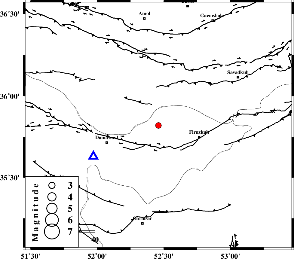
| Location | Lat:35.82 Lon: 52.46 |
| Region | Tehran Province, 29 km West of Firuzkuh |
Nearest Cities |
|
| 6 km North of Arjomand, Tehran Province | |
| 21 km North West of Shahrabad, Tehran Province | |
| 23 km South East of Baijan, Mazandaran Province | |
| 24 km North East of Sarbandan, Tehran Province | |
| 26 km East of Gaznak, Mazandaran Province | |
| Depth | 6 km |
| Agency | |
Faults within 150 km: |
|
| MOSHA_F (Length: 234 km) , Distance to epicenter: 14 km | |
| N_ALBORZ_F (Length: 360 km) , Distance to epicenter: 43 km | |
| ATARI_F (Length: 185 km) , Distance to epicenter: 47 km | |
| Number of Phases | 7 |
| RMS | 0.3 |
| Number of Stations | 7 |
| Error in Latitude | >7.5 km |
| Error in Longitude | 5.6 km |
| Error in Depth | 9 km |
Download waveform in seisan format
to download seisan software Click here
to access information about IIEES stations Click here
Amplitude | ||||||||
| UID | Agency | Station | Component | Amplitude | Period | Arrival Time | Proccessing Time | Signal Clip |
| 81378 | IIEES | THKV | N | 155.2 | 0.31 | 2012-01-16 11:44:51 | 2012-01-16 11:03:00 | n |
| 81379 | IIEES | GHVR | E | 130.5 | 0.47 | 2012-01-16 11:45:06 | 2012-01-16 11:03:00 | n |
| 81380 | IIEES | ASAO | E | 60.6 | 0.42 | 2012-01-16 11:45:18 | 2012-01-16 11:03:00 | n |
| 81381 | IIEES | ASAO | N | 47.9 | 0.38 | 2012-01-16 11:45:18 | 2012-01-16 11:03:00 | n |
Phase | ||||||||||||
| Agency | Station | Component | Phase Type | Phase Quality | First Motion | Observed Arrival Time | Time Residual | Loc. Flag | Input Weight | Distance | Azimuth | |
| IIEES | CHTH | Z | Pg | E | 2012-01-16 11:44:23 | -0.18 | y | 121 | 275 | |||
| IIEES | THKV | Z | Pg | E | 2012-01-16 11:44:26 | -0.29 | y | 143 | 275 | |||
| IIEES | GHVR | Z | Pn | E | 2012-01-16 11:44:33 | -0.33 | y | 185 | 217 | |||
| IIEES | ASAO | Z | Pn | E | 2012-01-16 11:44:43 | 0.07 | y | 263 | 238 | |||
| IIEES | SHRO | Z | Pn | E | 2012-01-16 11:44:50 | -0.1 | y | 321 | 85 | |||
| IIEES | KHMZ | Z | Pn | E | 2012-01-16 11:44:51 | 0.45 | y | 325 | 225 | |||
| IIEES | ZNJK | Z | Pn | E | 2012-01-16 11:44:55 | 0.49 | y | 352 | 287 | |||