
Magnitude |
:2.5 |
| Date & Time (UTC) | 2012-01-14 20:45:06.5 |
| Date & Time (Local) | 1390/10/25 00:15:06.5 |
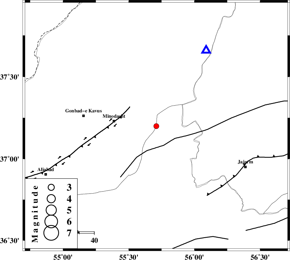
| Location | Lat:37.2 Lon: 55.71 |
| Region | Semnan Province, 29 km East of Minodasht |
Nearest Cities |
|
| 10 km North of Rezvan, Semnan Province | |
| 10 km East of Farsian, Golestan Province | |
| 15 km North East of Duzin, Golestan Province | |
| 20 km North of Nardin, Semnan Province | |
| 20 km South of Aq qamish, Golestan Province | |
| Depth | 41 km |
| Agency | |
Faults within 150 km: |
|
| ROBATE_QARABIL_F (Length: 168 km) , Distance to epicenter: 14 km | |
| JAJARAM_F (Length: 77 km) , Distance to epicenter: 58 km | |
| SHAVAR_F (Length: 87 km) , Distance to epicenter: 65 km | |
| Number of Phases | 4 |
| RMS | 0 |
| Number of Stations | 3 |
| Error in Latitude | >3.8 km |
| Error in Longitude | 8.8 km |
| Error in Depth | 7.7 km |
Download waveform in seisan format
to download seisan software Click here
to access information about IIEES stations Click here
Amplitude | ||||||||
| UID | Agency | Station | Component | Amplitude | Period | Arrival Time | Proccessing Time | Signal Clip |
| 81359 | IIEES | MRVT | E | 333.4 | 0.64 | 2012-01-14 20:45:28 | 2012-01-14 08:08:00 | n |
| 81360 | IIEES | BJRD | E | 37.7 | 0.6 | 2012-01-14 20:45:58 | 2012-01-14 08:08:00 | n |
Phase | ||||||||||||
| Agency | Station | Component | Phase Type | Phase Quality | First Motion | Observed Arrival Time | Time Residual | Loc. Flag | Input Weight | Distance | Azimuth | |
| IIEES | MRVT | Z | Pg | E | 2012-01-14 20:45:18 | 0 | y | 60.9 | 33 | |||
| IIEES | SHRO | Z | Pg | E | 2012-01-14 20:45:29 | 0 | y | 135 | 168 | |||
| IIEES | BJRD | Z | Pg | E | 2012-01-14 20:45:32 | y | 160 | 69 | ||||
| IIEES | MRVT | N | Sg | E | 2012-01-14 20:45:27 | y | ||||||