
Magnitude |
:3 |
| Date & Time (UTC) | 2012-01-11 17:22:27.8 |
| Date & Time (Local) | 1390/10/21 20:52:27.8 |
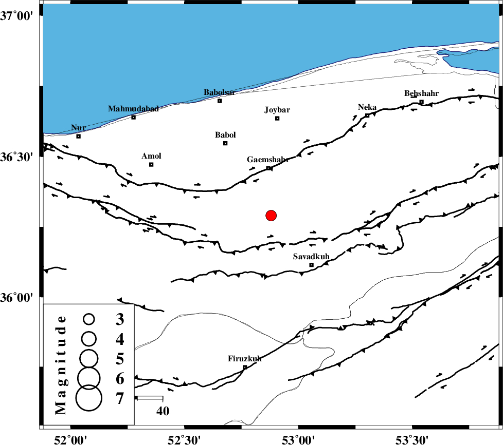
| Location | Lat:36.29 Lon: 52.88 |
| Region | Mazandaran Province, 19 km South of Qaemshahr |
Nearest Cities |
|
| 2 km of Shirgah, Mazandaran Province | |
| 4 km of Kij khalil, Mazandaran Province | |
| 14 km North West of Utu, Mazandaran Province | |
| 15 km East of Derazkola, Mazandaran Province | |
| 16 km North of Zirab, Mazandaran Province | |
| Depth | 14 km |
| Agency | |
Faults within 150 km: |
|
| N_ALBORZ_F (Length: 360 km) , Distance to epicenter: 13 km | |
| KHAZAR_F (Length: 523 km) , Distance to epicenter: 16 km | |
| ATARI_F (Length: 185 km) , Distance to epicenter: 66 km | |
| Number of Phases | 5 |
| RMS | 0.1 |
| Number of Stations | 4 |
| Error in Latitude | >7.8 km |
| Error in Longitude | 4.6 km |
| Error in Depth | 5.3 km |
Download waveform in seisan format
to download seisan software Click here
to access information about IIEES stations Click here
Amplitude | ||||||||
| UID | Agency | Station | Component | Amplitude | Period | Arrival Time | Proccessing Time | Signal Clip |
| 81330 | IIEES | THKV | N | 151.5 | 0.56 | 2012-01-11 17:23:23 | 2012-01-11 04:48:00 | n |
| 81331 | IIEES | THKV | E | 154.3 | 0.36 | 2012-01-11 17:23:23 | 2012-01-11 04:48:00 | n |
Phase | ||||||||||||
| Agency | Station | Component | Phase Type | Phase Quality | First Motion | Observed Arrival Time | Time Residual | Loc. Flag | Input Weight | Distance | Azimuth | |
| IIEES | CHTH | Z | Pg | E | 2012-01-11 17:22:54 | -0.11 | y | 164 | 255 | |||
| IIEES | THKV | Z | Pn | E | 2012-01-11 17:22:58 | 0.06 | y | 185 | 258 | |||
| IIEES | THKV | N | Sg | E | 2012-01-11 17:23:20 | 0.06 | y | 185 | 258 | |||
| IIEES | MRVT | Z | Pn | E | 2012-01-11 17:23:15 | 0 | y | 323 | 61 | |||
| IIEES | ASAO | Z | Pn | E | 2012-01-11 17:23:15 | -0.02 | y | 324 | 234 | |||