
Magnitude |
:4 |
| Date & Time (UTC) | 2012-01-07 23:25:33.8 |
| Date & Time (Local) | 1390/10/18 02:55:33.8 |
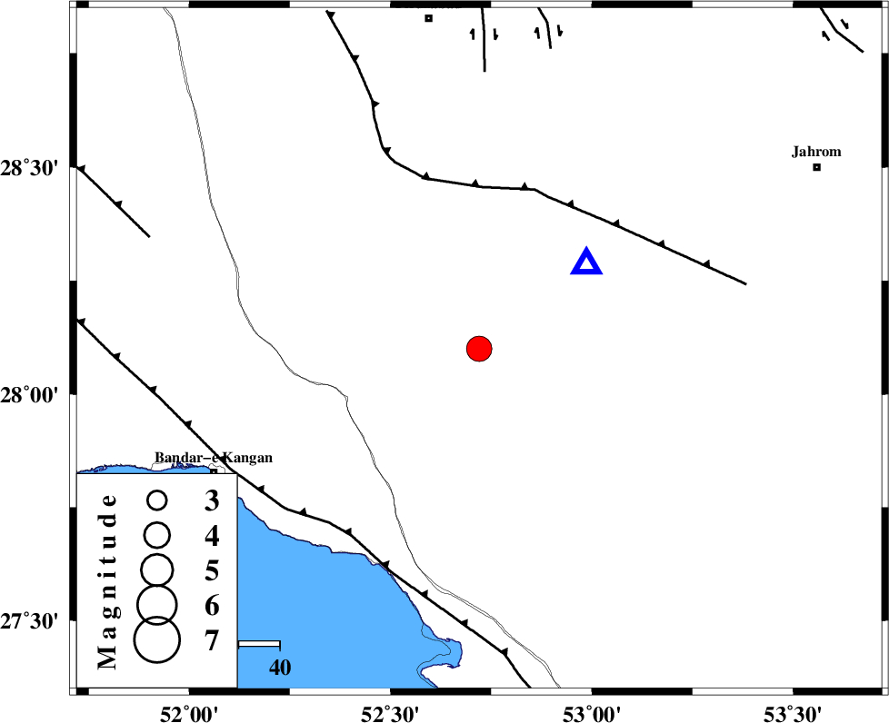
| Location | Lat:28.1 Lon: 52.72 |
| Region | Fars Province, 50 km North-East of Jam |
Nearest Cities |
|
| 11 km North of Garmesht, Fars Province | |
| 30 km South of Hengam, Fars Province | |
| 41 km North of Asir, Fars Province | |
| 42 km West of Seyfabad, Fars Province | |
| 42 km East of Dolatabad, Fars Province | |
| Depth | 14 km |
| Agency | |
Faults within 150 km: |
|
| QIR_F (Length: 130 km) , Distance to epicenter: 40 km | |
| MFF3 (Length: 292 km) , Distance to epicenter: 55 km | |
| SABZ_PUSHAN_F_Z1 (Length: 69 km) , Distance to epicenter: 68 km | |
| Number of Phases | 4 |
| RMS | 0.1 |
| Number of Stations | 5 |
| Error in Latitude | >5 km |
| Error in Longitude | 2.5 km |
| Error in Depth | 4.9 km |
Download waveform in seisan format
to download seisan software Click here
to access information about IIEES stations Click here
Amplitude | ||||||||
| UID | Agency | Station | Component | Amplitude | Period | Arrival Time | Proccessing Time | Signal Clip |
| 81287 | IIEES | GHIR | E | 18882.9 | 0.36 | 2012-01-07 23:25:49 | 2012-01-07 10:55:00 | n |
| 81288 | IIEES | AHRM | N | 4564.7 | 0.64 | 2012-01-07 23:26:35 | 2012-01-07 10:55:00 | n |
| 81289 | IIEES | BNDS | E | 236.7 | 0.56 | 2012-01-07 23:27:42 | 2012-01-07 10:55:00 | n |
| 81290 | IIEES | KRBR | E | 119.9 | 0.56 | 2012-01-07 23:27:55 | 2012-01-07 10:55:00 | n |
Phase | ||||||||||||
| Agency | Station | Component | Phase Type | Phase Quality | First Motion | Observed Arrival Time | Time Residual | Loc. Flag | Input Weight | Distance | Azimuth | |
| IIEES | GHIR | Z | Pg | E | 2012-01-07 23:25:40 | -0.11 | y | 33.1 | 52 | |||
| IIEES | AHRM | Z | Pg | E | 2012-01-07 23:26:00 | -0.07 | y | 163 | 302 | |||
| IIEES | BNDS | Z | Pn | E | 2012-01-07 23:26:25 | 0.05 | y | 349 | 102 | |||
| IIEES | NASN | Z | Pn | E | 2012-01-07 23:26:46 | 0.22 | y | 521 | 1 | |||