
Magnitude |
:3.3 |
| Date & Time (UTC) | 2012-01-03 16:47:33.3 |
| Date & Time (Local) | 1390/10/13 20:17:33.3 |
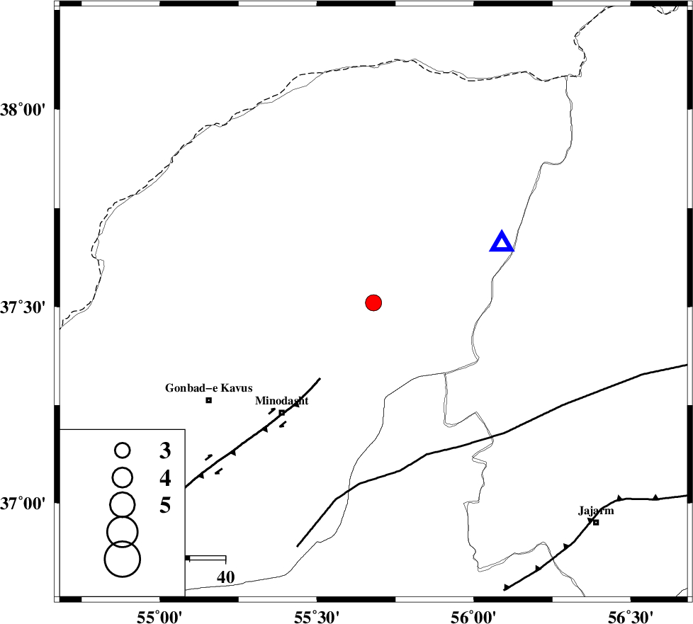
| Location | Lat:37.51 Lon: 55.68 |
| Region | Golestan Province, 22 km North-East of Kalaleh |
Nearest Cities |
|
| 5 km of Pashikmar, Golestan Province | |
| 14 km North East of Ajen sangarli, Golestan Province | |
| 17 km North of Aq qamish, Golestan Province | |
| 18 km North East of Tamarqarquzi-e sofla, Golestan Province | |
| 22 km North East of Kalaleh, Golestan Province | |
| Depth | 15 km |
| Agency | |
Faults within 150 km: |
|
| ROBATE_QARABIL_F (Length: 168 km) , Distance to epicenter: 45 km | |
| KHAZAR_F (Length: 523 km) , Distance to epicenter: 84 km | |
| JAJARAM_F (Length: 77 km) , Distance to epicenter: 87 km | |
| Number of Phases | 4 |
| RMS | 0 |
| Number of Stations | 3 |
| Error in Latitude | >5.1 km |
| Error in Longitude | 8.7 km |
| Error in Depth | 21 km |
Download waveform in seisan format
to download seisan software Click here
to access information about IIEES stations Click here
Amplitude | ||||||||
| UID | Agency | Station | Component | Amplitude | Period | Arrival Time | Proccessing Time | Signal Clip |
| 81234 | IIEES | MRVT | E | 3298.5 | 0.32 | 2012-01-03 16:47:46 | 2012-01-03 04:06:00 | n |
| 81235 | IIEES | MRVT | N | 5241.7 | 0.56 | 2012-01-03 16:47:46 | 2012-01-03 04:06:00 | n |
| 81236 | IIEES | BJRD | N | 241.4 | 0.36 | 2012-01-03 16:48:26 | 2012-01-03 04:06:00 | n |
Phase | ||||||||||||
| Agency | Station | Component | Phase Type | Phase Quality | First Motion | Observed Arrival Time | Time Residual | Loc. Flag | Input Weight | Distance | Azimuth | |
| IIEES | MRVT | Z | Pg | E | 2012-01-03 16:47:40 | 0 | y | 39.7 | 66 | |||
| IIEES | MRVT | E | Sg | E | 2012-01-03 16:47:46 | 0 | y | 39.7 | 66 | |||
| IIEES | BJRD | Z | Pg | E | 2012-01-03 16:47:58 | 0.01 | y | 154 | 82 | |||
| IIEES | SHRO | Z | Pg | E | 2012-01-03 16:48:01 | 0 | y | 170 | 170 | |||