
Magnitude |
:3.5 |
| Date & Time (UTC) | 2012-01-03 03:56:40.0 |
| Date & Time (Local) | 1390/10/13 07:26:40.0 |
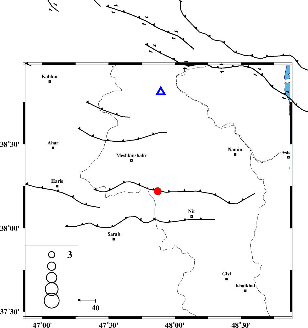
| Location | Lat:38.22 Lon: 47.87 |
| Region | Ardebil Province, 26 km South-East of Meshgin Shahr |
Nearest Cities |
|
| 16 km South East of Manueil, Ardebil Province | |
| 18 km North West of Eslamabad, Ardebil Province | |
| 21 km North West of Varniab, Ardebil Province | |
| 21 km West of Sardabeh, Ardebil Province | |
| 23 km North West of Sareyin, Ardebil Province | |
| Depth | 14 km |
| Agency | |
Faults within 150 km: |
|
| BOZQUSH (Length: 70 km) , Distance to epicenter: 30 km | |
| SANGAVAR_F (Length: 61 km) , Distance to epicenter: 57 km | |
| MASULEL_F (Length: 90 km) , Distance to epicenter: 84 km | |
| Number of Phases | 8 |
| RMS | 0.5 |
| Number of Stations | 6 |
| Error in Latitude | >2.8 km |
| Error in Longitude | 8.7 km |
| Error in Depth | 9.8 km |
Download waveform in seisan format
to download seisan software Click here
to access information about IIEES stations Click here
Amplitude | ||||||||
| UID | Agency | Station | Component | Amplitude | Period | Arrival Time | Proccessing Time | Signal Clip |
| 81232 | IIEES | THKV | E | 113.1 | 0.52 | 2012-01-03 03:58:29 | 2012-01-03 03:15:00 | n |
Phase | ||||||||||||
| Agency | Station | Component | Phase Type | Phase Quality | First Motion | Observed Arrival Time | Time Residual | Loc. Flag | Input Weight | Distance | Azimuth | |
| IIEES | GRMI | Z | Pg | E | 2012-01-03 03:56:50 | -0.56 | y | 65.2 | 2 | |||
| IIEES | GRMI | E | Sg | E | 2012-01-03 03:56:59 | -0.11 | y | 65.2 | 2 | |||
| IIEES | MAKU | Z | Pn | E | 2012-01-03 03:57:26 | 0.67 | y | 304 | 295 | |||
| IIEES | SNGE | Z | Pn | E | 2012-01-03 03:57:31 | -0.11 | y | 350 | 188 | |||
| IIEES | SNGE | E | Sg | E | 2012-01-03 03:58:17 | -0.52 | y | 350 | 188 | |||
| IIEES | THKV | Z | Pn | E | 2012-01-03 03:57:33 | -0.06 | y | 370 | 133 | |||
| IIEES | CHTH | Z | Pn | E | 2012-01-03 03:57:36 | 0.81 | y | 387 | 131 | |||
| IIEES | ASAO | Z | Pn | E | 2012-01-03 03:57:43 | -0.03 | y | 451 | 154 | |||