
Magnitude |
:2.8 |
| Date & Time (UTC) | 2012-01-01 22:31:11.5 |
| Date & Time (Local) | 1390/10/12 02:01:11.5 |
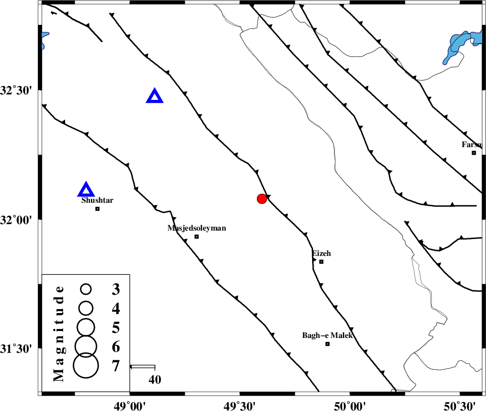
| Location | Lat:32.08 Lon: 49.6 |
| Region | Khoozestan Province, 32 km North-East of Masjed Soleyman |
Nearest Cities |
|
| 21 km South East of Qale-yekhvaju, Khoozestan Province | |
| 23 km North West of Torshak, Khoozestan Province | |
| 24 km South of Paabshalal, Khoozestan Province | |
| 31 km North West of Rasvand, Khoozestan Province | |
| 32 km North East of Masjed Soleyman, Khoozestan Province | |
| Depth | 15 km |
| Agency | |
Faults within 150 km: |
|
| MFF2 (Length: 205 km) , Distance to epicenter: 3 km | |
| DEZFUL_EMBAYMENT (Length: 228 km) , Distance to epicenter: 37 km | |
| ZARDKUH_F (Length: 139 km) , Distance to epicenter: 50 km | |
| Number of Phases | 6 |
| RMS | 0 |
| Number of Stations | 4 |
| Error in Latitude | >3.3 km |
| Error in Longitude | 4.7 km |
| Error in Depth | 3.2 km |
Download waveform in seisan format
to download seisan software Click here
to access information about IIEES stations Click here
Amplitude | ||||||||
| UID | Agency | Station | Component | Amplitude | Period | Arrival Time | Proccessing Time | Signal Clip |
| 81224 | IIEES | SHGR | N | 432.2 | 0.28 | 2012-01-01 22:31:41 | 2012-01-01 09:52:00 | n |
| 81225 | IIEES | SHGR | E | 458.4 | 0.56 | 2012-01-01 22:31:49 | 2012-01-01 09:52:00 | n |
| 81226 | IIEES | KHMZ | N | 94.5 | 0.48 | 2012-01-01 22:32:10 | 2012-01-01 09:52:00 | n |
| 81227 | IIEES | KHMZ | E | 115.1 | 0.64 | 2012-01-01 22:32:13 | 2012-01-01 09:52:00 | n |
Phase | ||||||||||||
| Agency | Station | Component | Phase Type | Phase Quality | First Motion | Observed Arrival Time | Time Residual | Loc. Flag | Input Weight | Distance | Azimuth | |
| IIEES | SHGR | Z | Pg | E | 2012-01-01 22:31:24 | 0.01 | y | 75.4 | 272 | |||
| IIEES | KHMZ | Z | Pg | E | 2012-01-01 22:31:42 | -0.02 | y | 187 | 10 | |||
| IIEES | KHMZ | E | Sg | E | 2012-01-01 22:32:05 | 0.08 | y | 187 | 10 | |||
| IIEES | ASAO | Z | Pn | E | 2012-01-01 22:31:53 | 0.01 | y | 276 | 8 | |||
| IIEES | ASAO | N | Sg | E | 2012-01-01 22:32:29 | -0.07 | y | 276 | 8 | |||
| IIEES | SNGE | Z | Pn | E | 2012-01-01 22:32:08 | -0.01 | y | 394 | 329 | |||