
Magnitude |
:2.8 |
| Date & Time (UTC) | 2011-12-30 07:51:54.0 |
| Date & Time (Local) | 1390/10/9 11:21:54.0 |
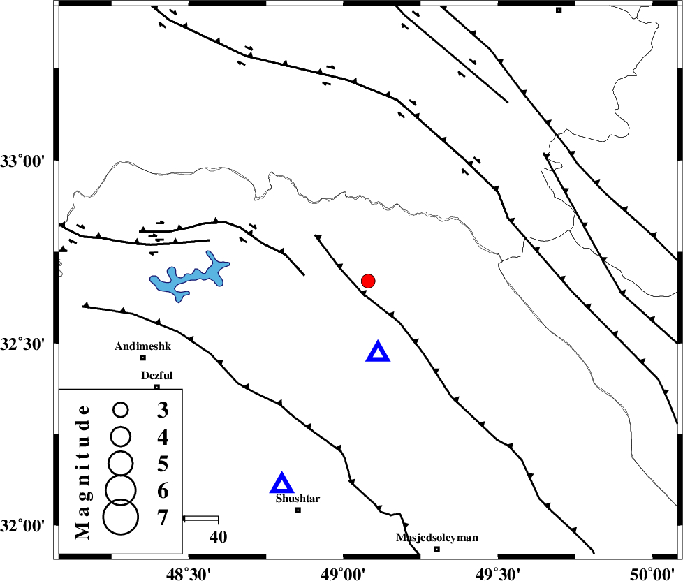
| Location | Lat:32.67 Lon: 49.08 |
| Region | Khoozestan Province, 31 km North of Lali |
Nearest Cities |
|
| 29 km South East of Shuy, Khoozestan Province | |
| 29 km North East of Sardasht, Khoozestan Province | |
| 31 km North of Lali, Khoozestan Province | |
| 44 km South East of Bargsar, Lorestan Province | |
| 44 km North of Jaefarabad, Khoozestan Province | |
| Depth | 15 km |
| Agency | |
Faults within 150 km: |
|
| MFF2 (Length: 205 km) , Distance to epicenter: 4 km | |
| BALARUD_F_Z2 (Length: 58 km) , Distance to epicenter: 19 km | |
| DEZFUL_EMBAYMENT (Length: 228 km) , Distance to epicenter: 46 km | |
| Number of Phases | 6 |
| RMS | 0.1 |
| Number of Stations | 4 |
| Error in Latitude | >2.4 km |
| Error in Longitude | 5 km |
| Error in Depth | 4.5 km |
Download waveform in seisan format
to download seisan software Click here
to access information about IIEES stations Click here
Amplitude | ||||||||
| UID | Agency | Station | Component | Amplitude | Period | Arrival Time | Proccessing Time | Signal Clip |
| 81213 | IIEES | SHGR | E | 657 | 0.44 | 2011-12-30 07:52:22 | 2011-12-30 08:01:00 | n |
| 81214 | IIEES | SHGR | N | 459.3 | 0.76 | 2011-12-30 07:52:25 | 2011-12-30 08:01:00 | n |
Phase | ||||||||||||
| Agency | Station | Component | Phase Type | Phase Quality | First Motion | Observed Arrival Time | Time Residual | Loc. Flag | Input Weight | Distance | Azimuth | |
| IIEES | SHGR | Z | Pg | E | 2011-12-30 07:52:05 | 0.05 | y | 67.2 | 203 | |||
| IIEES | KHMZ | Z | Pg | E | 2011-12-30 07:52:17 | -0.18 | y | 145 | 34 | |||
| IIEES | KHMZ | N | Sg | E | 2011-12-30 07:52:35 | 0.03 | y | 145 | 34 | |||
| IIEES | ASAO | Z | Pn | E | 2011-12-30 07:52:29 | 0.05 | y | 226 | 22 | |||
| IIEES | ASAO | E | Sg | E | 2011-12-30 07:52:58 | 0.1 | y | 226 | 22 | |||
| IIEES | SNGE | Z | Pn | E | 2011-12-30 07:52:40 | -0.05 | y | 314 | 330 | |||