
Magnitude |
:3.9 |
| Date & Time (UTC) | 2011-12-26 20:18:08.4 |
| Date & Time (Local) | 1390/10/5 23:48:08.4 |
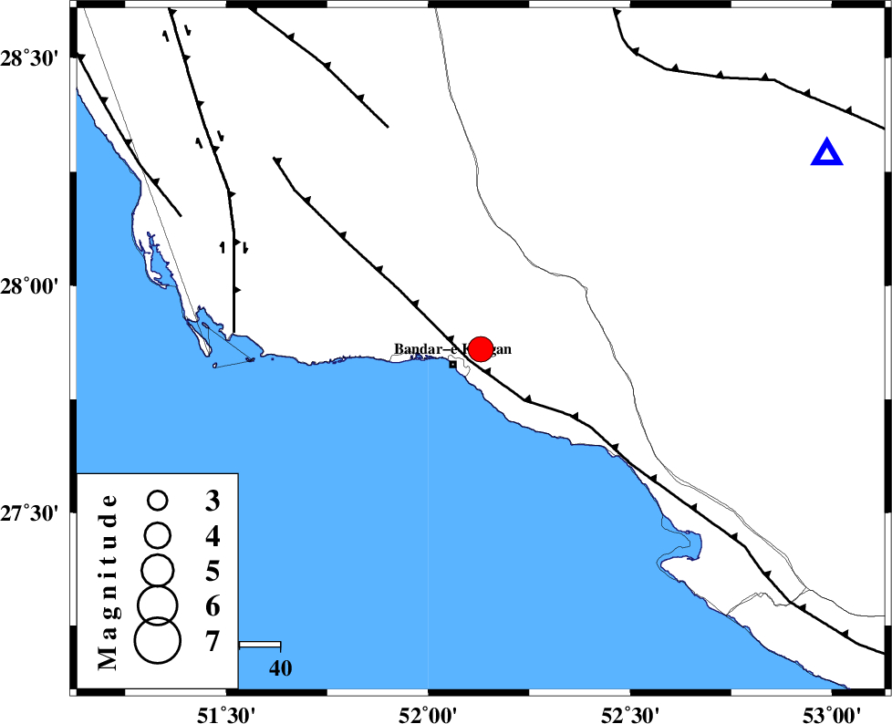
| Location | Lat:27.86 Lon: 52.13 |
| Region | Bushehr Province, 8 km Bandar-e kangan |
Nearest Cities |
|
| 8 km North of Bandar-e kangan, Bushehr Province | |
| 19 km North West of Jam, Bushehr Province | |
| 21 km South of Riz, Bushehr Province | |
| 30 km North West of Bandar-e taheri, Bushehr Province | |
| 36 km South West of Dolatabad, Fars Province | |
| Depth | 38 km |
| Agency | |
Faults within 150 km: |
|
| MFF3 (Length: 292 km) , Distance to epicenter: 4 km | |
| MFF5 (Length: 74 km) , Distance to epicenter: 59 km | |
| BORAZJAN_F (Length: 168 km) , Distance to epicenter: 60 km | |
| Number of Phases | 8 |
| RMS | 0.2 |
| Number of Stations | 8 |
| Error in Latitude | >5.7 km |
| Error in Longitude | 3.4 km |
| Error in Depth | 2.8 km |
Download waveform in seisan format
to download seisan software Click here
to access information about IIEES stations Click here
Amplitude | ||||||||
| UID | Agency | Station | Component | Amplitude | Period | Arrival Time | Proccessing Time | Signal Clip |
| 81146 | IIEES | GHIR | E | 2908.6 | 0.48 | 2011-12-26 20:18:53 | 2011-12-26 07:40:00 | n |
| 81147 | IIEES | GHIR | N | 2613.4 | 0.56 | 2011-12-26 20:18:54 | 2011-12-26 07:40:00 | n |
| 81148 | IIEES | AHRM | E | 2300.1 | 0.72 | 2011-12-26 20:18:57 | 2011-12-26 07:40:00 | n |
| 81149 | IIEES | AHRM | N | 2749.3 | 0.4 | 2011-12-26 20:19:02 | 2011-12-26 07:40:00 | n |
Phase | ||||||||||||
| Agency | Station | Component | Phase Type | Phase Quality | First Motion | Observed Arrival Time | Time Residual | Loc. Flag | Input Weight | Distance | Azimuth | |
| IIEES | GHIR | Z | Pg | E | 2011-12-26 20:18:25 | -0.08 | y | 96.2 | 61 | |||
| IIEES | AHRM | Z | Pg | E | 2011-12-26 20:18:31 | 0.09 | y | 138 | 324 | |||
| IIEES | BNDS | Z | Pn | E | 2011-12-26 20:19:03 | -0.04 | y | 402 | 96 | |||
| IIEES | KRBR | Z | Pn | E | 2011-12-26 20:19:17 | 0.21 | y | 509 | 61 | |||
| IIEES | NASN | Z | Pn | E | 2011-12-26 20:19:22 | -0.17 | y | 551 | 7 | |||
| IIEES | KHMZ | Z | Pn | E | 2011-12-26 20:19:39 | 0.04 | y | 684 | 343 | |||
| IIEES | TABS | Z | Pn | E | 2011-12-26 20:19:53 | 0.17 | y | 800 | 35 | |||
| IIEES | SNGE | Z | Pn | E | 2011-12-26 20:20:08 | -0.34 | y | 922 | 332 | |||