
Magnitude |
:2.7 |
| Date & Time (UTC) | 2011-12-24 22:56:20.4 |
| Date & Time (Local) | 1390/10/4 02:26:20.4 |
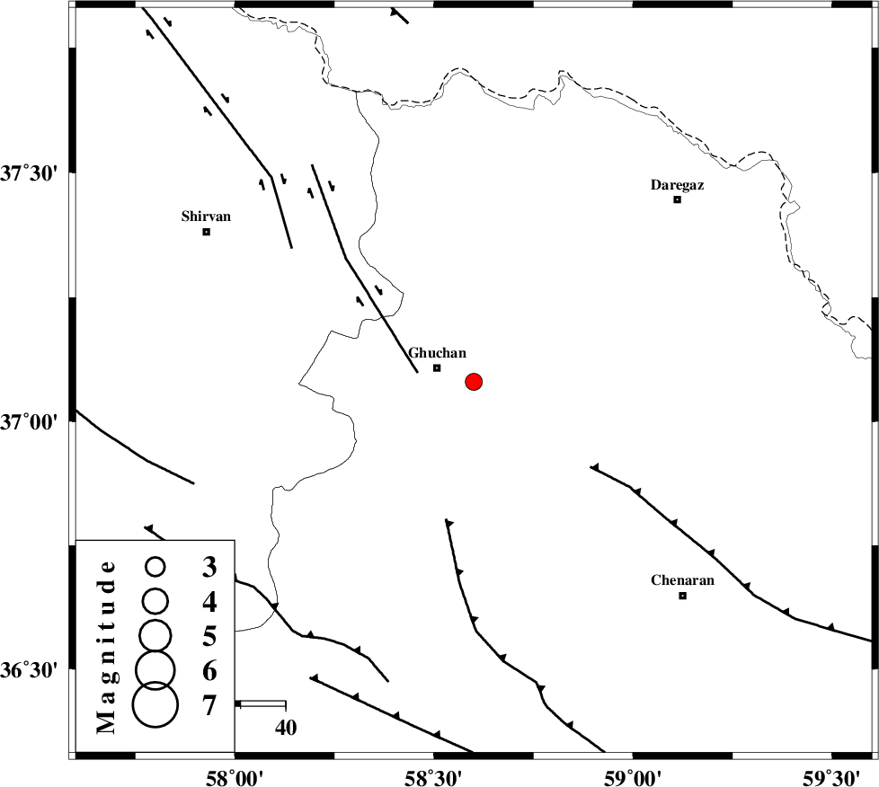
| Location | Lat:37.08 Lon: 58.6 |
| Region | Khorasan(center) Province, 9 km Quchan |
Nearest Cities |
|
| 2 km North of Ali Abad, Khorasan(center) Province | |
| 9 km of Quchan, Khorasan(center) Province | |
| 9 km of Mazraj, Khorasan(center) Province | |
| 19 km East of Shahr-e kohneh, Khorasan(center) Province | |
| 29 km North East of Yangi qaleh, Khorasan(center) Province | |
| Depth | 6 km |
| Agency | |
Faults within 150 km: |
|
| GHUCHAN_F (Length: 50 km) , Distance to epicenter: 13 km | |
| BINALUD_F1 (Length: 129 km) , Distance to epicenter: 31 km | |
| BINALUD_F1 (Length: 178 km) , Distance to epicenter: 32 km | |
| Number of Phases | 5 |
| RMS | 0.1 |
| Number of Stations | 5 |
| Error in Latitude | >4.5 km |
| Error in Longitude | 5.4 km |
| Error in Depth | 5.2 km |
Download waveform in seisan format
to download seisan software Click here
to access information about IIEES stations Click here
Amplitude | ||||||||
| UID | Agency | Station | Component | Amplitude | Period | Arrival Time | Proccessing Time | Signal Clip |
| 81095 | IIEES | BJRD | E | 194.5 | 0.4 | 2011-12-24 22:57:02 | 2011-12-25 05:01:00 | n |
| 81096 | IIEES | MRVT | E | 60.2 | 0.32 | 2011-12-24 22:57:27 | 2011-12-25 05:01:00 | n |
| 81097 | IIEES | MRVT | N | 62.6 | 0.36 | 2011-12-24 22:57:37 | 2011-12-25 05:01:00 | n |
| 81098 | IIEES | SHRO | N | 41.8 | 0.52 | 2011-12-24 22:57:36 | 2011-12-25 05:01:00 | n |
| 81099 | IIEES | SHRO | E | 45.5 | 0.64 | 2011-12-24 22:57:36 | 2011-12-25 05:01:00 | n |
Phase | ||||||||||||
| Agency | Station | Component | Phase Type | Phase Quality | First Motion | Observed Arrival Time | Time Residual | Loc. Flag | Input Weight | Distance | Azimuth | |
| IIEES | BJRD | Z | Pg | E | 2011-12-24 22:56:42 | -0.02 | y | 126 | 303 | |||
| IIEES | MRVT | Z | Pn | E | 2011-12-24 22:56:57 | -0.01 | y | 232 | 287 | |||
| IIEES | SHRO | Z | Pn | E | 2011-12-24 22:57:01 | 0.08 | y | 261 | 244 | |||
| IIEES | TABS | Z | Pn | E | 2011-12-24 22:57:19 | -0.11 | y | 404 | 200 | |||
| IIEES | SHRT | Z | P | E | 2011-12-24 22:57:20 | 0.04 | y | 410 | 158 | |||