
Magnitude |
:2.6 |
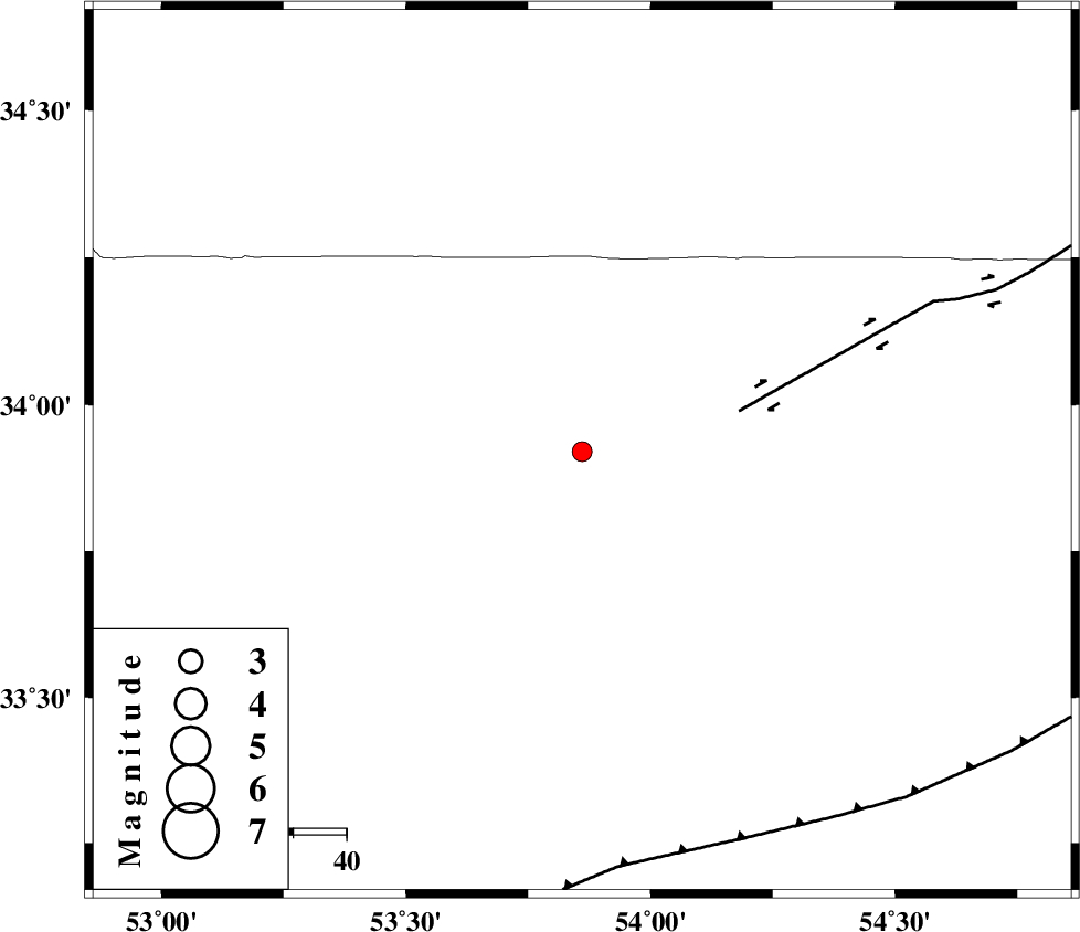
| Date & Time (UTC) | 2011-12-21 11:19:13.1 |
| Date & Time (Local) | 1390/9/30 14:49:13.1 |
| Location | Lat:33.92 Lon: 53.86 |
| Region | Esfahan Province, 179 km North-West of Ardakan |
Nearest Cities |
|
| 53 km South West of Jondaq, Esfahan Province | |
| 56 km North East of Maedan, Esfahan Province | |
| 58 km North West of Chupanan, Esfahan Province | |
| 69 km North East of Anarak, Esfahan Province | |
| 100 km North West of Farrokhi, Esfahan Province | |
| Depth | 18 km |
| Agency | |
Faults within 150 km: |
|
| DORUNEH_F (Length: 713 km) , Distance to epicenter: 31 km | |
| BIABANAK_F (Length: 162 km) , Distance to epicenter: 79 km | |
| CHAH_ZANGUL_F (Length: 123 km) , Distance to epicenter: 111 km | |
| Number of Phases | 5 |
| RMS | 0.2 |
| Number of Stations | 4 |
| Error in Latitude | >5.3 km |
| Error in Longitude | 6.3 km |
| Error in Depth | 7.9 km |
Download waveform in seisan format
to download seisan software Click here
to access information about IIEES stations Click here
Amplitude | ||||||||
| UID | Agency | Station | Component | Amplitude | Period | Arrival Time | Proccessing Time | Signal Clip |
| 81068 | IIEES | NASN | N | 142 | 0.13 | 2011-12-21 11:20:01 | 2011-12-21 10:34:00 | n |
| 81069 | IIEES | NASN | E | 107.6 | 0.22 | 2011-12-21 11:20:01 | 2011-12-21 10:34:00 | n |
| 81070 | IIEES | GHVR | E | 38.4 | 0.3 | 2011-12-21 11:20:24 | 2011-12-21 10:34:00 | n |
| 81071 | IIEES | GHVR | N | 25.2 | 0.33 | 2011-12-21 11:20:24 | 2011-12-21 10:34:00 | n |
| 81072 | IIEES | SHRO | N | 20.6 | 0.34 | 2011-12-21 11:20:51 | 2011-12-21 10:34:00 | n |
Phase | ||||||||||||
| Agency | Station | Component | Phase Type | Phase Quality | First Motion | Observed Arrival Time | Time Residual | Loc. Flag | Input Weight | Distance | Azimuth | |
| IIEES | NASN | Z | Pg | E | 2011-12-21 11:19:39 | 0.15 | y | 159 | 219 | |||
| IIEES | GHVR | Z | Pn | E | 2011-12-21 11:19:51 | -0.12 | y | 249 | 285 | |||
| IIEES | SHRO | Z | Pn | E | 2011-12-21 11:19:57 | -0.4 | y | 303 | 40 | |||
| IIEES | SHRO | N | Sg | E | 2011-12-21 11:20:38 | 0.25 | y | 303 | 40 | |||
| IIEES | CHTH | Z | Pn | E | 2011-12-21 11:20:02 | 0.13 | y | 333 | 312 | |||