
Magnitude |
:3.5 |
| Date & Time (UTC) | 2011-12-14 00:07:58.6 |
| Date & Time (Local) | 1390/9/23 03:37:58.6 |
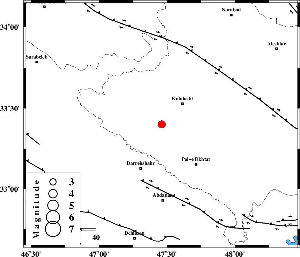
| Location | Lat:33.4 Lon: 47.46 |
| Region | Lorestan Province, 21 km South-West of Kuhdasht |
Nearest Cities |
|
| 8 km North of Suri, Lorestan Province | |
| 11 km of Ashtarheh golgol, Lorestan Province | |
| 11 km East of Kunani, Lorestan Province | |
| 13 km North of Chaqabol, Lorestan Province | |
| 20 km South West of Kuhdasht, Lorestan Province | |
| Depth | 17 km |
| Agency | |
Faults within 150 km: |
|
| BALARUD_F_Z1 (Length: 87 km) , Distance to epicenter: 41 km | |
| HZF4 (Length: 492 km) , Distance to epicenter: 55 km | |
| MFF6 (Length: 144 km) , Distance to epicenter: 75 km | |
| Number of Phases | 7 |
| RMS | 0.1 |
| Number of Stations | 5 |
| Error in Latitude | >1.9 km |
| Error in Longitude | 4.4 km |
| Error in Depth | 6.8 km |
Download waveform in seisan format
to download seisan software Click here
to access information about IIEES stations Click here
Amplitude | ||||||||
| UID | Agency | Station | Component | Amplitude | Period | Arrival Time | Proccessing Time | Signal Clip |
| 80991 | IIEES | SNGE | N | 627.3 | 0.4 | 2011-12-14 00:08:58 | 2011-12-13 11:28:00 | n |
| 80992 | IIEES | SNGE | E | 408.2 | 0.52 | 2011-12-14 00:09:00 | 2011-12-13 11:28:00 | n |
| 80993 | IIEES | SHGR | N | 512.7 | 0.88 | 2011-12-14 00:09:01 | 2011-12-13 11:28:00 | n |
Phase | ||||||||||||
| Agency | Station | Component | Phase Type | Phase Quality | First Motion | Observed Arrival Time | Time Residual | Loc. Flag | Input Weight | Distance | Azimuth | |
| IIEES | SNGE | Z | Pn | E | 2011-12-14 00:08:29 | -0.04 | y | 189 | 357 | |||
| IIEES | SHGR | Z | Pn | E | 2011-12-14 00:08:29 | -0.21 | y | 190 | 138 | |||
| IIEES | SHGR | E | Sg | E | 2011-12-14 00:08:52 | 0.12 | y | 190 | 138 | |||
| IIEES | KHMZ | Z | Pn | E | 2011-12-14 00:08:35 | -0.07 | y | 236 | 80 | |||
| IIEES | KHMZ | N | Sg | E | 2011-12-14 00:09:05 | -0.12 | y | 236 | 80 | |||
| IIEES | ASAO | Z | Pn | E | 2011-12-14 00:08:39 | 0.19 | y | 270 | 61 | |||
| IIEES | GHVR | Z | Pn | E | 2011-12-14 00:08:52 | 0.17 | y | 370 | 70 | |||