
Magnitude |
:2.7 |
| Date & Time (UTC) | 2011-12-09 02:25:00.5 |
| Date & Time (Local) | 1390/9/18 05:55:00.5 |
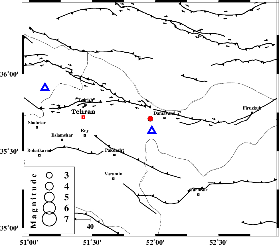
| Location | Lat:35.71 Lon: 51.96 |
| Region | Tehran Province, 10 km West of Damavand |
Nearest Cities |
|
| 7 km of Abali, Tehran Province | |
| 8 km North of Ab sard, Tehran Province | |
| 8 km of Rudehen, Tehran Province | |
| 9 km of Bumehen, Tehran Province | |
| 10 km West of Damavand, Tehran Province | |
| Depth | 23 km |
| Agency | |
Faults within 150 km: |
|
| MOSHA_F (Length: 234 km) , Distance to epicenter: 10 km | |
| N_TEHRAN_F4 (Length: 115 km) , Distance to epicenter: 20 km | |
| EYVANEKEY_F (Length: 74 km) , Distance to epicenter: 31 km | |
| Number of Phases | 7 |
| RMS | 0.1 |
| Number of Stations | 6 |
| Error in Latitude | >2 km |
| Error in Longitude | 5 km |
| Error in Depth | 3.8 km |
Download waveform in seisan format
to download seisan software Click here
to access information about IIEES stations Click here
Amplitude | ||||||||
| UID | Agency | Station | Component | Amplitude | Period | Arrival Time | Proccessing Time | Signal Clip |
| 80923 | IIEES | CHTH | E | 234.8 | 0.24 | 2011-12-09 02:25:24 | 2011-12-09 01:44:00 | n |
| 80924 | IIEES | THKV | E | 254 | 0.25 | 2011-12-09 02:25:33 | 2011-12-09 01:44:00 | n |
| 80925 | IIEES | GHVR | E | 110.4 | 0.2 | 2011-12-09 02:25:47 | 2011-12-09 01:44:00 | n |
| 80926 | IIEES | ASAO | E | 116.2 | 0.32 | 2011-12-09 02:26:03 | 2011-12-09 01:44:00 | n |
| 80927 | IIEES | ASAO | N | 91.5 | 0.24 | 2011-12-09 02:26:03 | 2011-12-09 01:44:00 | n |
| 80928 | IIEES | KHMZ | E | 26.4 | 0.44 | 2011-12-09 02:26:20 | 2011-12-09 01:44:00 | n |
| 80929 | IIEES | KHMZ | N | 26 | 0.36 | 2011-12-09 02:26:21 | 2011-12-09 01:44:00 | n |
Phase | ||||||||||||
| Agency | Station | Component | Phase Type | Phase Quality | First Motion | Observed Arrival Time | Time Residual | Loc. Flag | Input Weight | Distance | Azimuth | |
| IIEES | CHTH | Z | Pg | E | 2011-12-09 02:25:14 | -0.23 | y | 78.3 | 286 | |||
| IIEES | THKV | Z | Pg | E | 2011-12-09 02:25:17 | 0.14 | y | 100 | 283 | |||
| IIEES | THKV | E | Sg | E | 2011-12-09 02:25:29 | 0.06 | y | 100 | 283 | |||
| IIEES | GHVR | Z | Pg | E | 2011-12-09 02:25:25 | 0.14 | y | 152 | 206 | |||
| IIEES | GHVR | N | Sg | E | 2011-12-09 02:25:43 | -0.09 | y | 152 | 206 | |||
| IIEES | ASAO | Z | Pn | E | 2011-12-09 02:25:34 | 0.01 | y | 219 | 234 | |||
| IIEES | ZNJK | Z | Pn | E | 2011-12-09 02:25:46 | -0.04 | y | 313 | 291 | |||