
Magnitude |
:3.3 |
| Date & Time (UTC) | 2011-12-01 14:47:21.4 |
| Date & Time (Local) | 1390/9/10 18:17:21.4 |
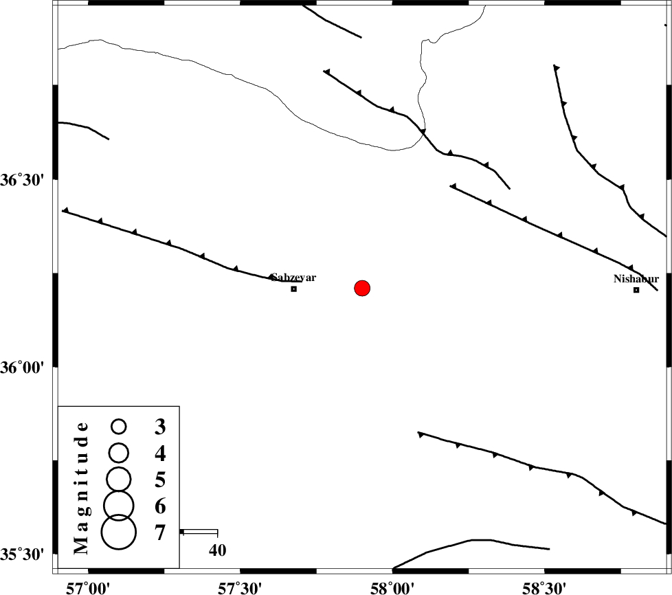
| Location | Lat:36.21 Lon: 57.9 |
| Region | Khorasan(center) Province, 21 km East of Sabzevar |
Nearest Cities |
|
| 20 km North East of Sabzevar, Khorasan(center) Province | |
| 27 km South West of Soltanabad, Khorasan(center) Province | |
| 30 km South West of Rebatjaz, Khorasan(center) Province | |
| 30 km North East of Sheshtamad, Khorasan(center) Province | |
| 36 km North West of Shamkan, Khorasan(center) Province | |
| Depth | 15 km |
| Agency | |
Faults within 150 km: |
|
| SABZEVAR_F (Length: 81 km) , Distance to epicenter: 18 km | |
| NAYSHABUR_F (Length: 74 km) , Distance to epicenter: 40 km | |
| BALHAR_F (Length: 117 km) , Distance to epicenter: 46 km | |
| Number of Phases | 5 |
| RMS | 0.6 |
| Number of Stations | 5 |
| Error in Latitude | >6.6 km |
| Error in Longitude | 6.4 km |
| Error in Depth | 0 km |
Download waveform in seisan format
to download seisan software Click here
to access information about IIEES stations Click here
Amplitude | ||||||||
| UID | Agency | Station | Component | Amplitude | Period | Arrival Time | Proccessing Time | Signal Clip |
| 80868 | IIEES | SHRO | E | 362.6 | 0.48 | 2011-12-01 14:48:15 | 2011-12-01 02:04:00 | n |
| 80869 | IIEES | SHRO | N | 455.6 | 0.48 | 2011-12-01 14:48:15 | 2011-12-01 02:04:00 | n |
Phase | ||||||||||||
| Agency | Station | Component | Phase Type | Phase Quality | First Motion | Observed Arrival Time | Time Residual | Loc. Flag | Input Weight | Distance | Azimuth | |
| IIEES | BJRD | Z | Pn | E | 2011-12-01 14:47:50 | 0 | y | 171 | 345 | |||
| IIEES | SHRO | Z | Pn | E | 2011-12-01 14:47:49 | -0.82 | y | 172 | 263 | |||
| IIEES | MRVT | Z | Pn | E | 2011-12-01 14:47:57 | 0.46 | y | 228 | 315 | |||
| IIEES | TABS | Z | Pn | E | 2011-12-01 14:48:06 | 0.88 | y | 293 | 194 | |||
| IIEES | SHRT | Z | Pn | E | 2011-12-01 14:48:13 | -0.55 | y | 358 | 142 | |||