
Magnitude |
:3.2 |
| Date & Time (UTC) | 2011-11-30 23:49:07.8 |
| Date & Time (Local) | 1390/9/10 03:19:07.8 |
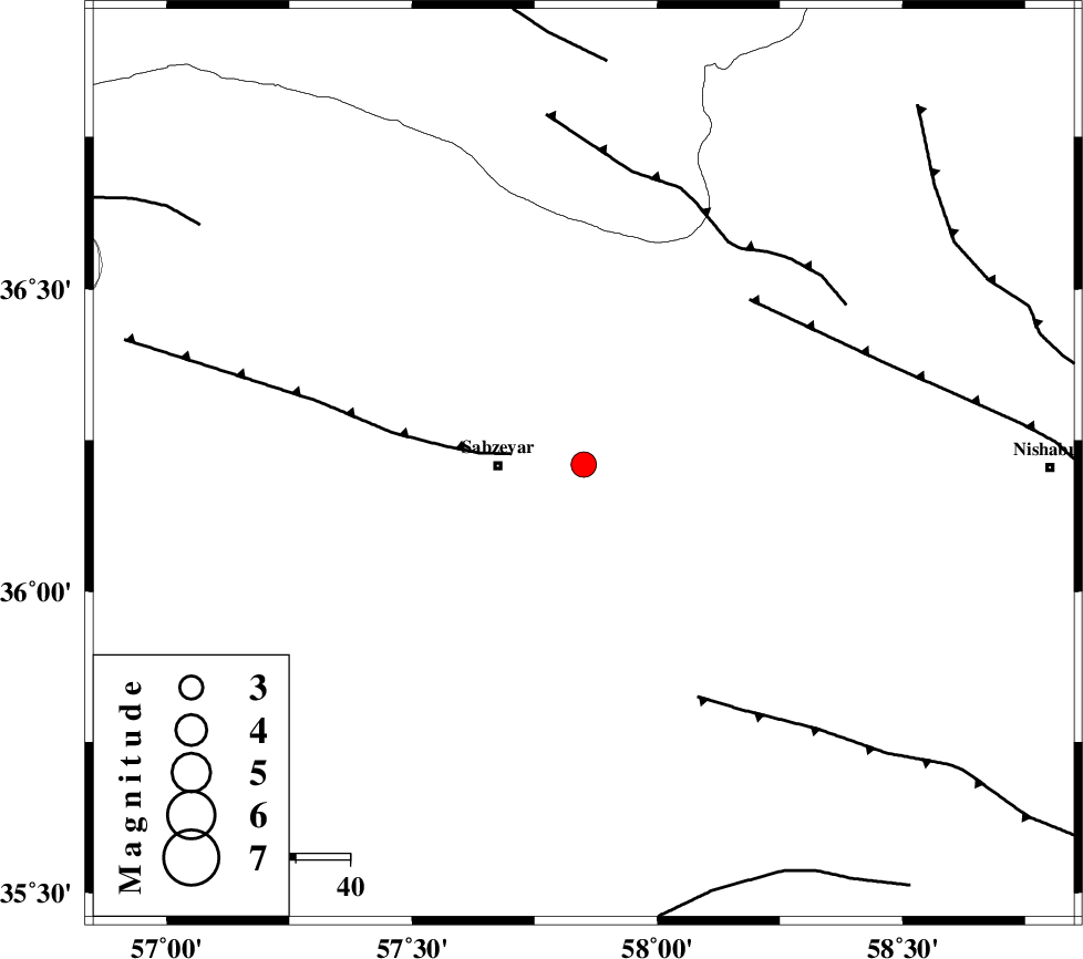
| Location | Lat:36.21 Lon: 57.85 |
| Region | Khorasan(center) Province, 16 km East of Sabzevar |
Nearest Cities |
|
| 16 km North East of Sabzevar, Khorasan(center) Province | |
| 29 km North of Sheshtamad, Khorasan(center) Province | |
| 30 km South West of Soltanabad, Khorasan(center) Province | |
| 31 km South West of Rebatjaz, Khorasan(center) Province | |
| 40 km North West of Shamkan, Khorasan(center) Province | |
| Depth | 14 km |
| Agency | |
Faults within 150 km: |
|
| SABZEVAR_F (Length: 81 km) , Distance to epicenter: 13 km | |
| NAYSHABUR_F (Length: 74 km) , Distance to epicenter: 43 km | |
| BALHAR_F (Length: 117 km) , Distance to epicenter: 48 km | |
| Number of Phases | 6 |
| RMS | 0.1 |
| Number of Stations | 4 |
| Error in Latitude | >1.3 km |
| Error in Longitude | 3.1 km |
| Error in Depth | 4 km |
Download waveform in seisan format
to download seisan software Click here
to access information about IIEES stations Click here
Amplitude | ||||||||
| UID | Agency | Station | Component | Amplitude | Period | Arrival Time | Proccessing Time | Signal Clip |
| 80848 | IIEES | SHRO | N | 696.9 | 0.44 | 2011-11-30 23:50:00 | 2011-11-30 11:12:00 | n |
| 80849 | IIEES | SHRO | E | 583.7 | 0.48 | 2011-11-30 23:50:04 | 2011-11-30 11:12:00 | n |
| 80850 | IIEES | TABS | E | 44.3 | 0.6 | 2011-11-30 23:50:43 | 2011-11-30 11:12:00 | n |
| 80851 | IIEES | TABS | N | 76.2 | 0.68 | 2011-11-30 23:50:51 | 2011-11-30 11:12:00 | n |
Phase | ||||||||||||
| Agency | Station | Component | Phase Type | Phase Quality | First Motion | Observed Arrival Time | Time Residual | Loc. Flag | Input Weight | Distance | Azimuth | |
| IIEES | SHRO | Z | Pg | E | 2011-11-30 23:49:35 | -0.07 | y | 167 | 263 | |||
| IIEES | BJRD | Z | Pg | E | 2011-11-30 23:49:35 | -0.12 | y | 170 | 347 | |||
| IIEES | BJRD | E | Sg | E | 2011-11-30 23:49:56 | 0.06 | y | 170 | 347 | |||
| IIEES | MRVT | Z | Pn | E | 2011-11-30 23:49:43 | 0.02 | y | 224 | 316 | |||
| IIEES | MRVT | N | Sg | E | 2011-11-30 23:50:11 | 0.06 | y | 224 | 316 | |||
| IIEES | TABS | Z | Pn | E | 2011-11-30 23:49:51 | 0.05 | y | 292 | 193 | |||