
Magnitude |
:3 |
| Date & Time (UTC) | 2011-11-27 07:32:59.0 |
| Date & Time (Local) | 1390/9/6 11:02:59.0 |
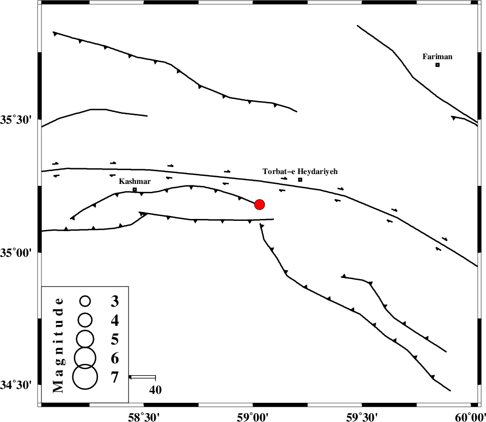
| Location | Lat:35.18 Lon: 59.03 |
| Region | Khorasan(center) Province, 20 km West of Torbat-e heydariyeh |
Nearest Cities |
|
| 1 km North of Shadmehr, Khorasan(center) Province | |
| 15 km West of Booriabad, Khorasan(center) Province | |
| 20 km West of Torbat-e heydariyeh, Khorasan(center) Province | |
| 21 km South of Babak, Khorasan(center) Province | |
| 24 km South West of Manzar, Khorasan(center) Province | |
| Depth | 14 km |
| Agency | |
Faults within 150 km: |
|
| KASHMAR_F (Length: 91 km) , Distance to epicenter: 1 km | |
| DUGHABAD_F (Length: 62 km) , Distance to epicenter: 8 km | |
| JANGAL_F (Length: 111 km) , Distance to epicenter: 8 km | |
| Number of Phases | 5 |
| RMS | 0.1 |
| Number of Stations | 4 |
| Error in Latitude | >4.9 km |
| Error in Longitude | 2.2 km |
| Error in Depth | 8.7 km |
Download waveform in seisan format
to download seisan software Click here
to access information about IIEES stations Click here
Amplitude | ||||||||
| UID | Agency | Station | Component | Amplitude | Period | Arrival Time | Proccessing Time | Signal Clip |
| 80809 | IIEES | SHRT | E | 99.2 | 0.36 | 2011-11-27 07:34:04 | 2011-11-27 06:53:00 | n |
| 80810 | IIEES | SHRT | N | 157.3 | 0.52 | 2011-11-27 07:34:07 | 2011-11-27 06:53:00 | n |
| 80811 | IIEES | TABS | E | 65.7 | 0.17 | 2011-11-27 07:34:11 | 2011-11-27 06:53:00 | n |
| 80812 | IIEES | TABS | N | 124.7 | 0.55 | 2011-11-27 07:34:17 | 2011-11-27 06:53:00 | n |
Phase | ||||||||||||
| Agency | Station | Component | Phase Type | Phase Quality | First Motion | Observed Arrival Time | Time Residual | Loc. Flag | Input Weight | Distance | Azimuth | |
| IIEES | SHRT | Z | Pg | E | 2011-11-27 07:33:32 | -0.02 | y | 205 | 145 | |||
| IIEES | TABS | Z | Pg | E | 2011-11-27 07:33:39 | 0.08 | y | 244 | 227 | |||
| IIEES | TABS | E | Sg | E | 2011-11-27 07:34:08 | -0.06 | y | 244 | 227 | |||
| IIEES | SHRO | Z | Pn | E | 2011-11-27 07:33:42 | -0.07 | y | 289 | 290 | |||
| IIEES | NASN | Z | Pn | E | 2011-11-27 07:34:25 | 0.14 | y | 632 | 247 | |||