
Magnitude |
:3 |
| Date & Time (UTC) | 2011-11-21 17:37:13.7 |
| Date & Time (Local) | 1390/8/30 21:07:13.7 |
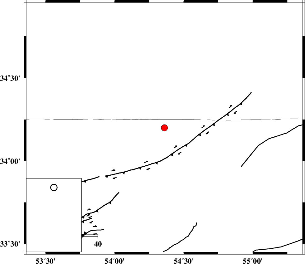
| Location | Lat:34.2 Lon: 54.36 |
| Region | Esfahan Province, 219 km South of Damghan |
Nearest Cities |
|
| 18 km North of Jondaq, Esfahan Province | |
| 65 km North of Chupanan, Esfahan Province | |
| 67 km North West of Farrokhi, Esfahan Province | |
| 82 km North West of Khur, Esfahan Province | |
| 107 km North West of Mehranjan, Esfahan Province | |
| Depth | 18 km |
| Agency | |
Faults within 150 km: |
|
| DORUNEH_F (Length: 713 km) , Distance to epicenter: 20 km | |
| BIABANAK_F (Length: 162 km) , Distance to epicenter: 94 km | |
| TORUD_F (Length: 136 km) , Distance to epicenter: 113 km | |
| Number of Phases | 6 |
| RMS | 0.2 |
| Number of Stations | 4 |
| Error in Latitude | >2.7 km |
| Error in Longitude | 1.4 km |
| Error in Depth | 4.5 km |
Download waveform in seisan format
to download seisan software Click here
to access information about IIEES stations Click here
Amplitude | ||||||||
| UID | Agency | Station | Component | Amplitude | Period | Arrival Time | Proccessing Time | Signal Clip |
| 80758 | IIEES | GHVR | N | 71.7 | 0.4 | 2011-11-21 17:38:38 | 2011-11-21 05:09:00 | n |
| 80759 | IIEES | GHVR | E | 94.7 | 0.52 | 2011-11-21 17:38:39 | 2011-11-21 05:09:00 | n |
| 80760 | IIEES | CHTH | E | 19.2 | 0.4 | 2011-11-21 17:38:51 | 2011-11-21 05:09:00 | n |
Phase | ||||||||||||
| Agency | Station | Component | Phase Type | Phase Quality | First Motion | Observed Arrival Time | Time Residual | Loc. Flag | Input Weight | Distance | Azimuth | |
| IIEES | NASN | Z | Pn | E | 2011-11-21 17:37:47 | -0.31 | y | 212 | 223 | |||
| IIEES | NASN | N | Sg | E | 2011-11-21 17:38:14 | 0.09 | y | 212 | 223 | |||
| IIEES | TABS | N | Pn | E | 2011-11-21 17:37:53 | 0.08 | y | 262 | 103 | |||
| IIEES | TABS | N | Sg | E | 2011-11-21 17:38:27 | 0.08 | y | 262 | 103 | |||
| IIEES | GHVR | N | Sg | E | 2011-11-21 17:38:35 | 0.21 | y | 288 | 277 | |||
| IIEES | CHTH | Z | Pn | E | 2011-11-21 17:38:04 | -0.16 | y | 351 | 304 | |||