
Magnitude |
:2.9 |
| Date & Time (UTC) | 2011-11-20 04:44:37.6 |
| Date & Time (Local) | 1390/8/29 08:14:37.6 |
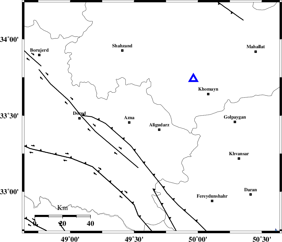
| Location | Lat:33.49 Lon: 49.64 |
| Region | Lorestan Province, 10 km Aligudarz |
Nearest Cities |
|
| 7 km North of Khameh sofla, Lorestan Province | |
| 11 km North of Aligudarz, Lorestan Province | |
| 11 km North of Sur, Lorestan Province | |
| 17 km South West of Javadiyeh, Markazi Province | |
| 17 km North East of Azna, Lorestan Province | |
| Depth | 8 km |
| Agency | |
Faults within 150 km: |
|
| MAIN_ZAGROS_R_F (Length: 1106 km) , Distance to epicenter: 26 km | |
| DORUD (Length: 100 km) , Distance to epicenter: 38 km | |
| ARDAL_F (Length: 170 km) , Distance to epicenter: 52 km | |
| Number of Phases | 6 |
| RMS | 0.1 |
| Number of Stations | 6 |
| Error in Latitude | >1.8 km |
| Error in Longitude | 2.2 km |
| Error in Depth | 3.6 km |
Download waveform in seisan format
to download seisan software Click here
to access information about IIEES stations Click here
Amplitude | ||||||||
| UID | Agency | Station | Component | Amplitude | Period | Arrival Time | Proccessing Time | Signal Clip |
| 80727 | IIEES | SHGR | N | 178.6 | 0.49 | 2011-11-20 04:45:28 | 2011-11-20 04:13:00 | n |
| 80728 | IIEES | SHGR | E | 122 | 0.58 | 2011-11-20 04:45:32 | 2011-11-20 04:13:00 | n |
| 80729 | IIEES | SNGE | N | 47.5 | 0.55 | 2011-11-20 04:46:06 | 2011-11-20 04:13:00 | n |
Phase | ||||||||||||
| Agency | Station | Component | Phase Type | Phase Quality | First Motion | Observed Arrival Time | Time Residual | Loc. Flag | Input Weight | Distance | Azimuth | |
| IIEES | KHMZ | Z | Pg | E | 2011-11-20 04:44:45 | 0.09 | y | 41.3 | 47 | |||
| IIEES | ASAO | Z | Pg | E | 2011-11-20 04:44:59 | 0.05 | y | 123 | 17 | |||
| IIEES | SHGR | Z | P | E | 2011-11-20 04:45:06 | 0 | y | 172 | 207 | |||
| IIEES | GHVR | Z | Pg | E | 2011-11-20 04:45:09 | -0.15 | y | 185 | 53 | |||
| IIEES | SNGE | Z | Pn | E | 2011-11-20 04:45:20 | -0.03 | y | 276 | 311 | |||
| IIEES | NASN | Z | Pn | E | 2011-11-20 04:45:24 | 0.04 | y | 305 | 104 | |||