
Magnitude |
:2.8 |
| Date & Time (UTC) | 2011-11-16 09:22:35.2 |
| Date & Time (Local) | 1390/8/25 12:52:35.2 |
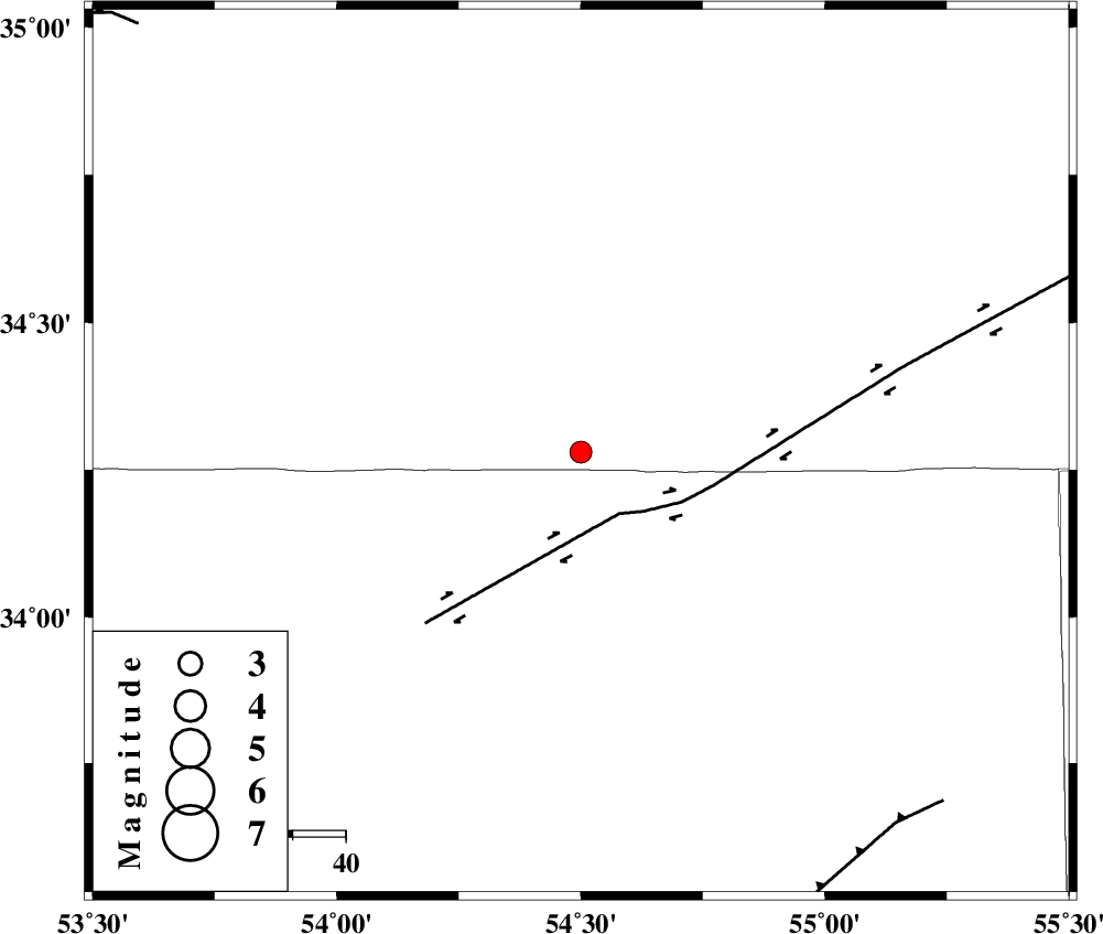
| Location | Lat:34.28 Lon: 54.5 |
| Region | Semnan Province, 210 km South-East of Damghan |
Nearest Cities |
|
| 27 km North of Jondaq, Esfahan Province | |
| 63 km North West of Farrokhi, Esfahan Province | |
| 74 km North East of Chupanan, Esfahan Province | |
| 78 km North West of Khur, Esfahan Province | |
| 106 km North West of Mehranjan, Esfahan Province | |
| Depth | 15 km |
| Agency | |
Faults within 150 km: |
|
| DORUNEH_F (Length: 713 km) , Distance to epicenter: 14 km | |
| BIABANAK_F (Length: 162 km) , Distance to epicenter: 92 km | |
| TORUD_F (Length: 136 km) , Distance to epicenter: 108 km | |
| Number of Phases | 4 |
| RMS | 0.4 |
| Number of Stations | 5 |
| Error in Latitude | >4.9 km |
| Error in Longitude | 3 km |
| Error in Depth | 0 km |
Download waveform in seisan format
to download seisan software Click here
to access information about IIEES stations Click here
Amplitude | ||||||||
| UID | Agency | Station | Component | Amplitude | Period | Arrival Time | Proccessing Time | Signal Clip |
| 80686 | IIEES | SHRO | E | 72 | 0.38 | 2011-11-16 09:23:43 | 2011-11-16 09:12:00 | n |
| 80687 | IIEES | GHVR | N | 20.3 | 0.44 | 2011-11-16 09:24:02 | 2011-11-16 09:12:00 | n |
| 80688 | IIEES | GHVR | E | 50.9 | 0.55 | 2011-11-16 09:24:02 | 2011-11-16 09:12:00 | n |
Phase | ||||||||||||
| Agency | Station | Component | Phase Type | Phase Quality | First Motion | Observed Arrival Time | Time Residual | Loc. Flag | Input Weight | Distance | Azimuth | |
| IIEES | NASN | Z | Pn | E | 2011-11-16 09:23:11 | -0.29 | y | 228 | 224 | |||
| IIEES | SHRO | Z | Pn | E | 2011-11-16 09:23:11 | -0.37 | y | 236 | 35 | |||
| IIEES | TABS | Z | Pn | E | 2011-11-16 09:23:14 | 0.32 | y | 252 | 105 | |||
| IIEES | CHTH | Z | Pn | E | 2011-11-16 09:23:27 | 0.41 | y | 357 | 301 | |||