
Magnitude |
:2.9 |
| Date & Time (UTC) | 2011-10-30 01:12:06.8 |
| Date & Time (Local) | 1390/8/8 04:42:06.8 |
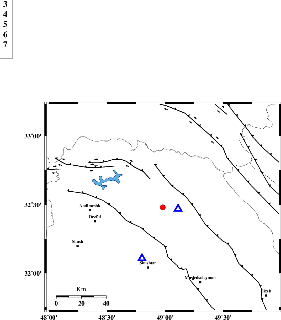
| Location | Lat:32.48 Lon: 48.98 |
| Region | Khoozestan Province, 16 km West of Lali |
Nearest Cities |
|
| 14 km East of Sardasht, Khoozestan Province | |
| 16 km North West of Lali, Khoozestan Province | |
| 27 km North West of Jaefarabad, Khoozestan Province | |
| 31 km North East of Gatvand, Khoozestan Province | |
| 31 km North East of Mahur berenji, Khoozestan Province | |
| Depth | 15 km |
| Agency | |
Faults within 150 km: |
|
| MFF2 (Length: 205 km) , Distance to epicenter: 19 km | |
| DEZFUL_EMBAYMENT (Length: 228 km) , Distance to epicenter: 24 km | |
| BALARUD_F_Z2 (Length: 58 km) , Distance to epicenter: 25 km | |
| Number of Phases | 3 |
| RMS | 0 |
| Number of Stations | 3 |
| Error in Latitude | >1.7 km |
| Error in Longitude | 3.7 km |
| Error in Depth | 0 km |
Download waveform in seisan format
to download seisan software Click here
to access information about IIEES stations Click here
Amplitude | ||||||||
| UID | Agency | Station | Component | Amplitude | Period | Arrival Time | Proccessing Time | Signal Clip |
| 80570 | IIEES | SHGR | N | 1662.2 | 0.14 | 2011-10-30 01:12:28 | 2011-10-30 02:24:00 | n |
| 80571 | IIEES | SHGR | E | 964.4 | 0.41 | 2011-10-30 01:12:29 | 2011-10-30 02:24:00 | n |
| 80572 | IIEES | KHMZ | N | 73.2 | 0.34 | 2011-10-30 01:13:02 | 2011-10-30 02:24:00 | n |
| 80573 | IIEES | SNGE | N | 45.4 | 0.91 | 2011-10-30 01:13:42 | 2011-10-30 02:24:00 | n |
Phase | ||||||||||||
| Agency | Station | Component | Phase Type | Phase Quality | First Motion | Observed Arrival Time | Time Residual | Loc. Flag | Input Weight | Distance | Azimuth | |
| IIEES | SHGR | Z | Pg | E | 2011-10-30 01:12:14 | 0 | y | 44.8 | 202 | |||
| IIEES | KHMZ | Z | Pg | E | 2011-10-30 01:12:34 | 0 | y | 167 | 33 | |||
| IIEES | SNGE | Z | Pn | E | 2011-10-30 01:12:55 | 0 | y | 326 | 333 | |||