
Magnitude |
:3 |
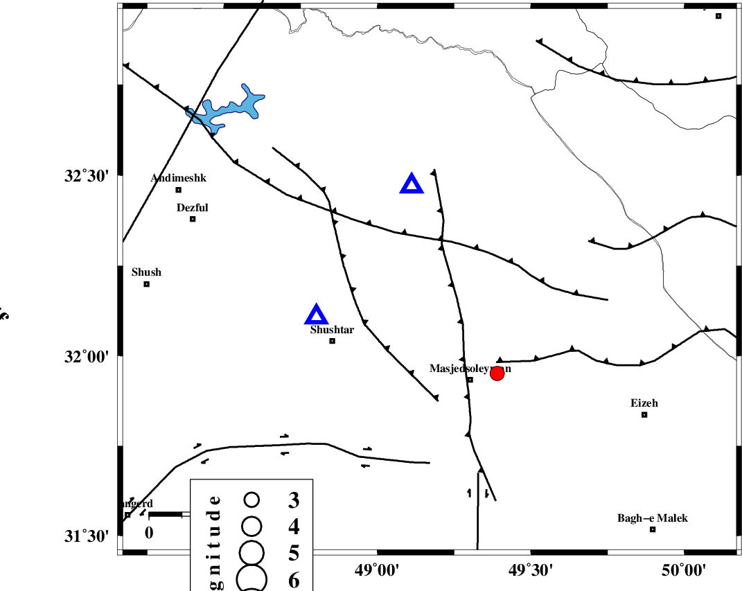
| Date & Time (UTC) | 2011-10-29 21:17:50.9 |
| Date & Time (Local) | 1390/8/8 00:47:50.9 |
| Location | Lat:32.21 Lon: 49.17 |
| Region | Khoozestan Province, 21 km South of Lali |
Nearest Cities |
|
| 8 km of Jaefarabad, Khoozestan Province | |
| 13 km North East of Haft shahidan, Khoozestan Province | |
| 21 km South of Lali, Khoozestan Province | |
| 26 km North West of Qale-yekhvaju, Khoozestan Province | |
| 30 km North East of Samaleh, Khoozestan Province | |
| Depth | 46 km |
| Agency | |
Faults within 150 km: |
|
| DEZFUL_EMBAYMENT (Length: 228 km) , Distance to epicenter: 16 km | |
| MFF2 (Length: 205 km) , Distance to epicenter: 23 km | |
| BALARUD_F_Z2 (Length: 58 km) , Distance to epicenter: 60 km | |
| Number of Phases | 4 |
| RMS | 0.1 |
| Number of Stations | 3 |
| Error in Latitude | >2.3 km |
| Error in Longitude | 3.1 km |
| Error in Depth | 3 km |
Download waveform in seisan format
to download seisan software Click here
to access information about IIEES stations Click here
Amplitude | ||||||||
| UID | Agency | Station | Component | Amplitude | Period | Arrival Time | Proccessing Time | Signal Clip |
| 80568 | IIEES | SHGR | N | 1026.2 | 0.99 | 2011-10-29 21:18:21 | 2011-10-29 09:47:00 | n |
| 80569 | IIEES | SNGE | N | 33.4 | 1.68 | 2011-10-29 21:19:39 | 2011-10-29 09:47:00 | n |
Phase | ||||||||||||
| Agency | Station | Component | Phase Type | Phase Quality | First Motion | Observed Arrival Time | Time Residual | Loc. Flag | Input Weight | Distance | Azimuth | |
| IIEES | SHGR | Z | Pg | E | 2011-10-29 21:18:00 | 0.03 | y | 36.9 | 252 | |||
| IIEES | KHMZ | Z | Pg | E | 2011-10-29 21:18:21 | 0.03 | y | 185 | 23 | |||
| IIEES | SNGE | Z | Pn | E | 2011-10-29 21:18:40 | -0.1 | y | 362 | 333 | |||
| IIEES | SNGE | E | Sg | E | 2011-10-29 21:19:30 | 0.04 | y | 362 | 333 | |||