
Magnitude |
:3.9 |
| Date & Time (UTC) | 2011-10-23 00:31:19.5 |
| Date & Time (Local) | 1390/8/1 04:01:19.5 |
| Location | Lat:28.1 Lon: 54.51 |
| Region | Fars Province, 50 km North-East of Lar |
Nearest Cities |
|
| 29 km South East of Shahr-e pir, Fars Province | |
| 29 km North of Dehkuyeh, Fars Province | |
| 30 km South of Hajiabad, Fars Province | |
| 46 km South East of Dabiran, Fars Province | |
| 46 km North East of Latifi, Fars Province | |
| Depth | 14 km |
| Agency | |
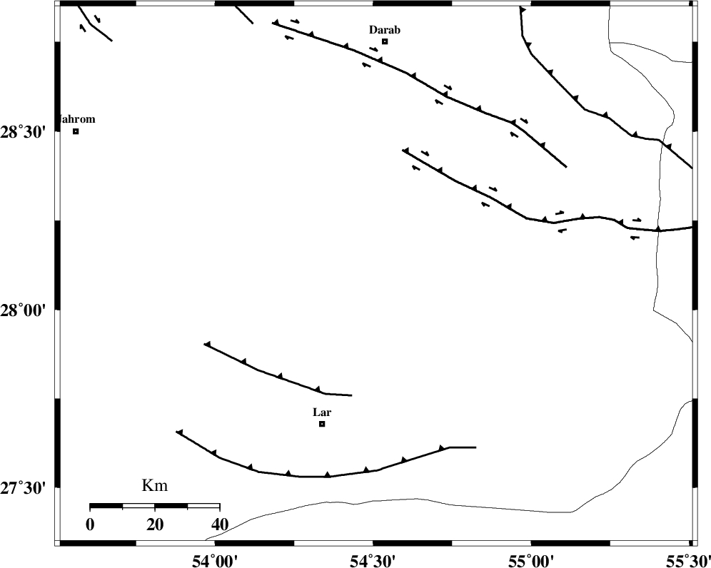
Faults within 150 km: |
|
| HZF2 (Length: 437 km) , Distance to epicenter: 38 km | |
| BERIZ_F (Length: 49 km) , Distance to epicenter: 39 km | |
| LAR_F (Length: 99 km) , Distance to epicenter: 59 km | |
| Number of Phases | 4 |
| RMS | 0.2 |
| Number of Stations | 3 |
| Error in Latitude | >7.2 km |
| Error in Longitude | 4.7 km |
| Error in Depth | 10.3 km |
Download waveform in seisan format
to download seisan software Click here
to access information about IIEES stations Click here
Amplitude | ||||||||
| UID | Agency | Station | Component | Amplitude | Period | Arrival Time | Proccessing Time | Signal Clip |
| 80513 | IIEES | GHIR | E | 1609.5 | 0.79 | 2011-10-23 00:32:08 | 2011-10-23 12:59:00 | n |
| 80514 | IIEES | KRBR | E | 349 | 0.17 | 2011-10-23 00:32:45 | 2011-10-23 12:59:00 | n |
| 80515 | IIEES | KRBR | N | 379.1 | 0.61 | 2011-10-23 00:32:46 | 2011-10-23 12:59:00 | n |
| 80516 | IIEES | CHBR | E | 39.5 | 0.4 | 2011-10-23 00:32:53 | 2011-10-23 12:59:00 | n |
| 80517 | IIEES | CHBR | N | 67.1 | 0.6 | 2011-10-23 00:32:55 | 2011-10-23 12:59:00 | n |
Phase | ||||||||||||
| Agency | Station | Component | Phase Type | Phase Quality | First Motion | Observed Arrival Time | Time Residual | Loc. Flag | Input Weight | Distance | Azimuth | |
| IIEES | GHIR | Z | Pg | E | 2011-10-23 00:31:44 | -0.08 | y | 151 | 278 | |||
| IIEES | KRBR | Z | Pn | E | 2011-10-23 00:32:05 | 0.37 | y | 302 | 46 | |||
| IIEES | KRBR | E | Sg | E | 2011-10-23 00:32:44 | -0.18 | y | 302 | 46 | |||
| IIEES | CHBR | Z | Pn | E | 2011-10-23 00:32:48 | -0.18 | y | 655 | 114 | |||